Rectortown Historic District
Also known as: Vdhr#030-5155

The pin is a point inside the NPS boundary polygon, not a surveyed location.
Why it's listed
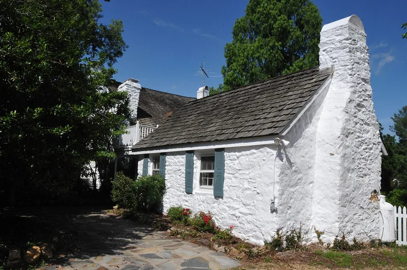
Rectortown is a small crossroads village in northeastern Fauquier County, Virginia, laid out under a 1772 act of the Virginia Assembly on land owned by John Rector. It is considered the oldest town in the county. The historic district covers roughly 115 acres and includes 81 contributing resources, mostly dwellings, along with churches, a school, an Odd Fellows hall, a post office, commercial buildings and cemeteries. Early buildings are log, stone and brick, including Maidstone Ordinary, the Rector-Slack Log House, Aspendale and the Brick Store House. Later frame houses show Federal, Greek Revival, Gothic Revival and Craftsman touches. The arrival of the Manassas Gap Railroad in 1852 spurred growth. During the Civil War the village served as Colonel John S. Mosby's unofficial headquarters, and General George McClellan was there when he learned he was relieved of command in 1862. The northern part of the district developed in the early twentieth century under African-American ownership. The district was recognized for its architecture, transportation history and military associations.
Significance in brief: The district is described as the oldest town in Fauquier County and keeps a largely intact collection of buildings from the late 18th to early 20th centuries. It is tied to the Manassas Gap Railroad, which was routed through the village in the 1850s. It also has Civil War associations as Colonel John S. Mosby's unofficial headquarters, and it grew an early-20th-century African-American community to the north.
Machine-generated summary. This summary was generated by a language model from the official nomination document and has not been reviewed line by line by an editor. It may contain errors. Check the source document before relying on any detail. Source: nomination document (PDF) · National Archives catalog entry. NRHP reference 04001267, listed November 27, 2004. Summary generated October 2026 (model claude-sonnet-5-5, prompt v1.0-2026-10-29, confidence high).
Key facts
| Address | Roughly bounded by Maidstone, Rectortown, Atoka, Lost Corner and Crenshae Rds., Rectortown |
|---|---|
| County | Fauquier County |
| Listed | November 27, 2004 |
| Reference number | 04001267 |
| Resource type | District |
| Period of significance | 1772-1954 |
| Architectural style | Greek Revival, Federal, Bungalow/Craftsman, I-house; mostly vernacular |
| Criteria |
|
| Areas of significance | Architecture, Transportation, Military |
| Level of significance | State |
| Status (as stated in the nomination) | Predominantly residential today with its own post office; most former stores have been converted to dwellings, and trains pass through without stopping. |
| Acreage | 115 |
| Within district | Cromwell's Run Rural Historic District |
| Coordinates | 38.92101, -77.85829 (NPS GIS) |
What listing means for this property
This is a historic district. Buildings within its boundary are either contributing (they add to the district's significance) or non-contributing. Owners of contributing income-producing buildings can claim the 20% federal rehabilitation tax credit; homeowners should look at state credits. National Register districts impose no design review by themselves; a local historic district ordinance, if one exists, does (the difference explained).
General information, not legal or tax advice. Rules change; confirm with your State Historic Preservation Office or a qualified adviser.
Sources and further reading
- National Park Service, National Register of Historic Places database (snapshot May 2026), reference 04001267.
- Nomination form (PDF, National Archives) — catalog entry
- Wikipedia article (used for cross-checking only; text not reproduced here)
- Wikidata Q14713115
- This listing as JSON
Last updated October 2026. Found an error? See the editorial policy for how to report it.