Auburn Battlefield
Also known as: . Coffee Hill Battlefield: DHR File No. 030-5140

Why it's listed
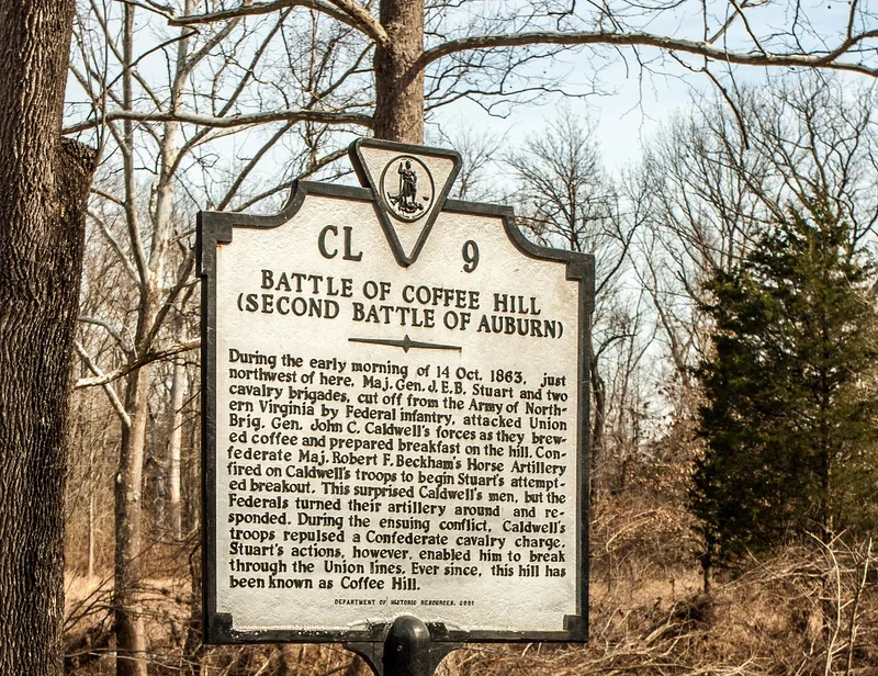
Auburn Battlefield is a rural district in Fauquier County, Virginia, about four miles southeast of Warrenton, spread across the Cedar Run watershed around the crossroads village of Auburn. Several of northern Virginia's oldest roads, including Rogues (Carolina) Road and Dumfries Road, meet here. In the eighteenth century George Neavil's ordinary and mill helped start the settlement, and in the early nineteenth century Stephen McCormick manufactured an award-winning plow in the village. Auburn later sat between Union and Confederate lines, and on October 13 and 14, 1863, armies fought across its fields and ridges. The district is significant for those engagements and for the terrain on which they unfolded, including the wooded heights of Chichester Hill and the road network that guided troop movements. Most land is still farmed or wooded, and the landscape keeps a high degree of integrity, although suburban growth and road work present pressures near Casanova, Catlett and Route 605.
Significance in brief: The district encompasses the ground of the Civil War engagements at Auburn on October 13 and 14, 1863. The nomination argues that the battlefield's key terrain, road network and agricultural landscape retain a high degree of integrity. It also documents Auburn's earlier role as a crossroads, milling and plow-manufacturing center.
Machine-generated summary. This summary was generated by a language model from the official nomination document and has not been reviewed line by line by an editor. It may contain errors. Check the source document before relying on any detail. Source: nomination document (PDF) · National Archives catalog entry. NRHP reference 11000873, listed December 5, 2011. Summary generated October 2026 (model claude-sonnet-5-5, prompt v1.0-2026-10-29, confidence medium).
Key facts
| Address | Bounded by Casanova, Auburn Baptist Church, & Catlett, Catlett |
|---|---|
| County | Fauquier County |
| Listed | December 5, 2011 |
| Reference number | 11000873 |
| Resource type | District |
| Architectural style | Early Republic; Mid-19th century Gothic Revival; Late 19th and early 20th century Colonial Revival |
| Areas of significance | Military, Historic - Non-Aboriginal |
| Level of significance | National |
| Status (as stated in the nomination) | Most land remains in agricultural and forest use, though suburban development and road construction on Route 605 threaten integrity. |
| Acreage | 3483 |
| Coordinates | 38.69139, -77.67857 (NPS GIS) |
What listing means for this property
This is a historic district. Buildings within its boundary are either contributing (they add to the district's significance) or non-contributing. Owners of contributing income-producing buildings can claim the 20% federal rehabilitation tax credit; homeowners should look at state credits. National Register districts impose no design review by themselves; a local historic district ordinance, if one exists, does (the difference explained).
General information, not legal or tax advice. Rules change; confirm with your State Historic Preservation Office or a qualified adviser.
Sources and further reading
- National Park Service, National Register of Historic Places database (snapshot May 2026), reference 11000873.
- Nomination form (PDF, National Archives) — catalog entry
- Wikipedia article (used for cross-checking only; text not reproduced here)
- Wikidata Q14711987
- This listing as JSON
Last updated October 2026. Found an error? See the editorial policy for how to report it.