Five Forks Battlefield

Why it's listed
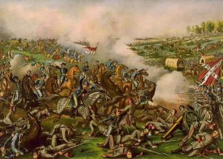
Five Forks Battlefield covers about 1,300 acres of woods and farm fields around a rural crossroads in Dinwiddie County, Virginia. Here on April 1, 1865, Union forces under Philip Sheridan crushed a Confederate command led by George Pickett and Fitzhugh Lee. The Confederates had been sent to protect the Southside Railroad, Robert E. Lee's last supply line. While Pickett and his officers dined at a shad bake, Warren's infantry struck the Confederate right and Union cavalry scattered the screen linking Pickett with the main army. The collapse forced the abandonment of the Petersburg defenses and led to the surrender at Appomattox about two weeks later. Much of the land is still held by descendants of the Gilliam family, who owned it during the war. Their late 18th-century house, Burnt Quarter, was occupied by Union soldiers after the fighting. Little of the light Confederate earthworks survives, though the landscape remains largely open and agricultural.
Significance in brief: The Union victory at Five Forks on April 1, 1865 broke the Confederate Petersburg defenses. Sheridan's forces crushed Pickett's and Fitzhugh Lee's defenders, which led to the loss of the Southside Railroad, Lee's last supply line. Lee's surrender at Appomattox followed within weeks.
Machine-generated summary. This summary was generated by a language model from the official nomination document and has not been reviewed line by line by an editor. It may contain errors. Check the source document before relying on any detail. Source: nomination document (PDF) · National Archives catalog entry. NRHP reference 66000830, listed October 15, 1966. Summary generated October 2026 (model claude-sonnet-5-5, prompt v1.0-2026-10-29, confidence medium).
Key facts
| Address | 12 mi. W of Petersburg on CR 627 at Church Rd., Petersburg |
|---|---|
| County | Dinwiddie County |
| Listed | October 15, 1966 |
| Reference number | 66000830 |
| Resource type | Site |
| Period of significance | 4/1/1865 |
| Areas of significance | Military |
| Level of significance | National |
| National Historic Landmark | Yes, designated December 19, 1960 |
| Status (as stated in the nomination) | Condition listed as good and unaltered on its original site. Most of the land is wooded tracts and cultivated fields, much as during the battle, and very little of the Confederate breastworks remains. |
| Acreage | 1300 |
| Coordinates | 37.13851, -77.61802 (NPS GIS) |
What listing means for this property
Sites (archaeological sites, battlefields, landscapes) are often listed with a restricted address to protect them from looting or disturbance. Listing is honorary for private owners; federal undertakings on or near the site go through Section 106 review, and state laws may protect burials and artefacts regardless of listing.
General information, not legal or tax advice. Rules change; confirm with your State Historic Preservation Office or a qualified adviser.
Sources and further reading
- National Park Service, National Register of Historic Places database (snapshot May 2026), reference 66000830.
- Nomination form (PDF, National Archives) — catalog entry
- Wikipedia article (used for cross-checking only; text not reproduced here)
- Wikidata Q5455943
- This listing as JSON
Last updated October 2026. Found an error? See the editorial policy for how to report it.