Bridge at Falling Creek
Also known as: VDHR File No. 20-135

Approximate location: the National Park Service places this pin arbitrarily within the property, not at a surveyed point (stated accuracy ±12 m).
Why it's listed
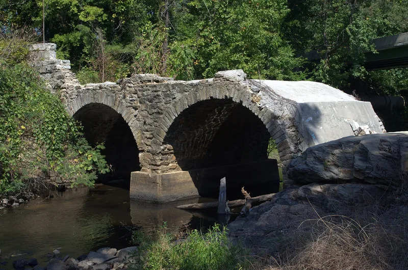
Spanning Falling Creek between the northbound and southbound lanes of US Route 1/301, this granite bridge was built about 1823-1824 for the Manchester and Petersburg Turnpike, a road chartered in 1816 to give travelers a more direct route between Richmond and Petersburg. Two semicircular arches of rough, uncoursed granite, probably quarried nearby, carry a roadway about 24 feet wide and 148 feet long with wing walls. William Carter of Richmond built the stonework at a reported cost of $2,043.26. The bridge was taken out of regular service shortly after 1931, when a new span carried southbound traffic. In 1934 the surrounding wayside was partly developed with Federal Aid funds and the help of a local garden club to protect it. It is recognized as one of only twelve known masonry-arched turnpike bridges in Virginia and as an early example of roadside preservation. A 1933 granite marker also stands on the site.
Significance in brief: The bridge is one of only twelve known masonry-arched turnpike bridges in Virginia. It is significant under Criterion A for Transportation, as part of a major north-south travel corridor, and under Criterion C for Engineering, as a fine early-nineteenth-century masonry arch bridge. Its preservation in the Falling Creek Wayside also reflects early highway beautification and historic preservation tied to tourism.
Machine-generated summary. This summary was generated by a language model from the official nomination document and has not been reviewed line by line by an editor. It may contain errors. Check the source document before relying on any detail. Source: nomination document (PDF) · National Archives catalog entry. NRHP reference 95001171, listed October 12, 1995. Summary generated October 2026 (model claude-sonnet-5-5, prompt v1.0-2026-10-29, confidence high).
Key facts
| Address | US 1/301 at Falling Cr., Richmond (Independent City) |
|---|---|
| County | Chesterfield County |
| Listed | October 12, 1995 |
| Reference number | 95001171 |
| Resource type | Structure |
| Period of significance | ca. 1823-1941 |
| Architect / builder | Carter, William |
| Architectural style | NO STYLE |
| Criteria |
|
| Areas of significance | Transportation, Engineering |
| Level of significance | Local |
| Status (as stated in the nomination) | Retired from vehicle service shortly after 1931; now preserved within the Falling Creek Wayside, which is used for outdoor recreation. |
| Acreage | 2.5 |
| Coordinates | 37.43957, -77.43916 (NPS GIS) |
What listing means for this property
For a publicly owned building or structure, listing mainly matters when federal funds, permits or licences are involved: projects then go through Section 106 review so effects on the property are considered. Listing also strengthens applications for preservation grants and, for leased income-producing uses, can enable the federal rehabilitation tax credit.
General information, not legal or tax advice. Rules change; confirm with your State Historic Preservation Office or a qualified adviser.
Sources and further reading
- National Park Service, National Register of Historic Places database (snapshot May 2026), reference 95001171.
- Nomination form (PDF, National Archives) — catalog entry
- Wikipedia article (used for cross-checking only; text not reproduced here)
- Wikidata Q14712074
- This listing as JSON
Last updated October 2026. Found an error? See the editorial policy for how to report it.