Charlottesville and Albemarle County Courthouse Historic District
Also known as: Charlottesville Historic District; See Also:Albemarle County

Why it's listed
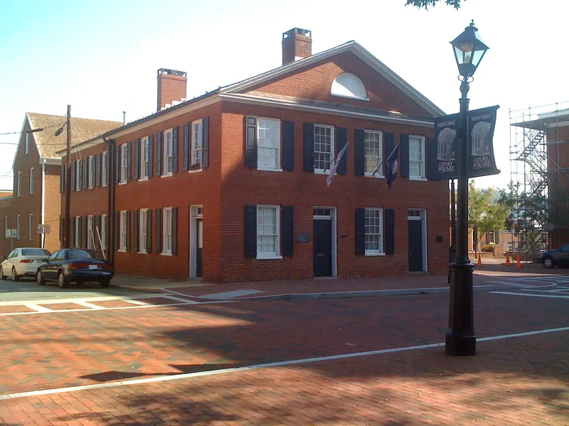
Charlottesville's historic district covers roughly 112 acres and about 300 buildings, taking in the town laid out in 1762 as the seat of Albemarle County, along with its 1818 annexation and parts of the 1860 annexation. At its center are Court Square, with the 1803 courthouse, and a Main Street commercial core that became a pedestrian mall in the 1970s. Around them are churches, a public library, a former school, two small parks with equestrian statues, railroad warehouses and a 1905 train station. Residential streets such as Park Street, North First Street and Altamont Circle show Federal, Italianate, Queen Anne, Colonial Revival and Bungalow styles. The district was recognized for its role as a regional political center, its links to Thomas Jefferson and to Revolutionary and Civil War events, and its range of 19th- and early 20th-century architecture. Demolition and urban renewal have left gaps, but the original street plan and many historic buildings survive.
Significance in brief: The district reflects Charlottesville's political, economic, social and architectural development from its founding as the Albemarle County seat. It has strong ties to Jefferson, the Revolutionary and Civil Wars, and a varied collection of 19th- and early 20th-century architecture. The original town plan helps give the city a sense of historic continuity.
Machine-generated summary. This summary was generated by a language model from the official nomination document and has not been reviewed line by line by an editor. It may contain errors. Check the source document before relying on any detail. Source: nomination document (PDF) · National Archives catalog entry. NRHP reference 82004904, listed July 28, 1982. Summary generated October 2026 (model claude-sonnet-5-5, prompt v1.0-2026-10-29, confidence medium).
Key facts
| Address | Roughly bounded by Park, Water, Saxton, and Main Sts., Charlottesville (Independent City) |
|---|---|
| County | Charlottesville |
| Listed | July 28, 1982 |
| Reference number | 82004904 |
| Resource type | District |
| Architectural style | Mixed: Federal, Greek Revival, Gothic Revival, Italianate, Queen Anne, Colonial Revival, Classical Revival and Bungalow |
| Areas of significance | Community Planning and Development, Military, Transportation, Exploration/Settlement, Politics/Government, Architecture |
| Level of significance | State |
| Status (as stated in the nomination) | Parts of the district have been altered by demolition, urban renewal, parking lots and some unsympathetic infill. The Park Street, North First Street and Altamont areas have changed little. The early 20th-century C&O train station is described as abandoned, and many Park Street houses are now offices. |
| Acreage | 112 |
| Coordinates | 38.03207, -78.47958 (NPS GIS) |
What listing means for this property
This is a historic district. Buildings within its boundary are either contributing (they add to the district's significance) or non-contributing. Owners of contributing income-producing buildings can claim the 20% federal rehabilitation tax credit; homeowners should look at state credits. National Register districts impose no design review by themselves; a local historic district ordinance, if one exists, does (the difference explained).
General information, not legal or tax advice. Rules change; confirm with your State Historic Preservation Office or a qualified adviser.
Sources and further reading
- National Park Service, National Register of Historic Places database (snapshot May 2026), reference 82004904.
- Nomination form (PDF, National Archives) — catalog entry
- Wikipedia article (used for cross-checking only; text not reproduced here)
- Wikidata Q15209173
- This listing as JSON
Last updated October 2026. Found an error? See the editorial policy for how to report it.