Green Hill

Why it's listed
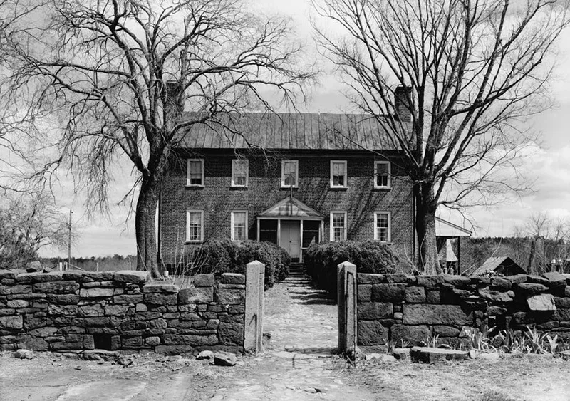
Green Hill is a plantation complex in Campbell County, Virginia, north of the Staunton River and southwest of Long Island. The main house is a two-story, five-bay Flemish bond brick building with a gable roof, modillioned cornice and two interior end chimneys. A one-story rear ell was probably built about 1800, and the front section was added soon after by Samuel Pannill, who bought the original land in 1797. Pannill served in the Virginia General Assembly, sat on the Board of Public Works and was president of the Roanoke Navigation Company. Inside, the house has notable woodwork, including a paneled chimney wall, a provincial entablature with reeding and scalloping, and a large mantel in the ell. Many outbuildings survive, among them a frame kitchen with an eighteen-foot stone chimney, a stone laundry, slave quarters, log barns, an ice house, a tobacco barn and a granary, linked by wide stone walkways. The variety of surviving farm buildings is the main reason for its listing.
Significance in brief: The nomination cites the fine interior woodwork, which is surprising given the simple exterior. It also stresses the survival of most of the outbuildings, which is especially valuable because they represent a variety of plantation functions.
Machine-generated summary. This summary was generated by a language model from the official nomination document and has not been reviewed line by line by an editor. It may contain errors. Check the source document before relying on any detail. Source: nomination document (PDF) · National Archives catalog entry. NRHP reference 69000226, listed November 12, 1969. Summary generated October 2026 (model claude-sonnet-5-5, prompt v1.0-2026-10-29, confidence medium).
Key facts
| Address | SW of Long Island near jct. of Rtes. 633 and 728, Long Island |
|---|---|
| County | Campbell County |
| Listed | November 12, 1969 |
| Reference number | 69000226 |
| Resource type | District |
| Period of significance | 19th Century |
| Architect / builder | Samuel Pannill (builder) |
| Areas of significance | Architecture, Agriculture |
| Level of significance | State |
| Status (as stated in the nomination) | Condition is marked fair; the form lists the property as occupied, with a ruined stone stable among the outbuildings. |
| Coordinates | 37.06442, -79.07089 (NPS GIS) |
What listing means for this property
This is a historic district. Buildings within its boundary are either contributing (they add to the district's significance) or non-contributing. Owners of contributing income-producing buildings can claim the 20% federal rehabilitation tax credit; homeowners should look at state credits. National Register districts impose no design review by themselves; a local historic district ordinance, if one exists, does (the difference explained).
General information, not legal or tax advice. Rules change; confirm with your State Historic Preservation Office or a qualified adviser.
Sources and further reading
- National Park Service, National Register of Historic Places database (snapshot May 2026), reference 69000226.
- Nomination form (PDF, National Archives) — catalog entry
- Wikipedia article (used for cross-checking only; text not reproduced here)
- Wikidata Q14712391
- This listing as JSON
Last updated October 2026. Found an error? See the editorial policy for how to report it.