Blenheim (Boundary Increase)
Also known as: VDHR No. 15-66

Why it's listed
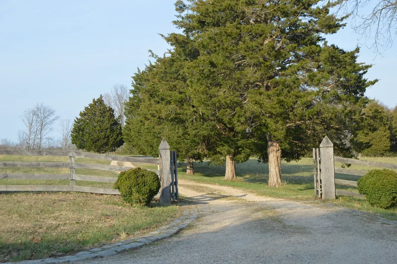
Blenheim is a 334-acre plantation on Falling River in eastern Campbell County, Virginia. Its focal point is a weatherboarded, story-and-a-half Federal-period house at the end of a half-mile cedar-lined lane, overlooking fields and the river bottom lands. The house keeps its original porches, beaded weatherboarding, louvered shutters and distinctive provincial Federal woodwork, and its main stair is noted for outstanding carved decoration. Remnants of an early formal garden east of the house may hold archaeological potential. The boundary increase brings the whole farm into the listing, since its limits roughly match those that defined the plantation before the Civil War. They include wooded uplands, open fields, the historic approach lane and the river bottoms. Together these preserve the rural context and screen the house from nearby modern housing. The scattered later outbuildings, dating from the late nineteenth and twentieth centuries, are compatible but not contributing. The period of significance runs from 1809 to 1870, under the architecture area.
Significance in brief: The form argues the house is significant for architecture, with a high degree of integrity and striking provincial Federal woodwork, including an outstanding carved main stair. The enlarged boundary preserves the historic rural setting, approximately the same acreage and lines that have defined the plantation since before the Civil War.
Machine-generated summary. This summary was generated by a language model from the official nomination document and has not been reviewed line by line by an editor. It may contain errors. Check the source document before relying on any detail. Source: nomination document (PDF) · National Archives catalog entry. NRHP reference 94000457, listed May 26, 1994. Summary generated October 2026 (model claude-sonnet-5-5, prompt v1.0-2026-10-29, confidence medium).
Key facts
| Address | E of VA 648, 3500 ft. S of jct. with VA 604, Spring Mills |
|---|---|
| County | Campbell County |
| Listed | May 26, 1994 |
| Reference number | 94000457 |
| Resource type | Building |
| Period of significance | 1809-1870 |
| Architect / builder | unknown |
| Architectural style | Early Republic: Federal |
| Criteria |
|
| Areas of significance | Architecture |
| Level of significance | State |
| Status (as stated in the nomination) | The house is still a single dwelling; the outbuildings were amended to show agricultural outbuildings as their current function. Several farm buildings have been demolished and one barn and granary is ruinous. |
| Acreage | 331 |
| Coordinates | 37.22515, -78.94718 (NPS GIS) |
What listing means for this property
National Register listing is honorary: it recognises significance and does not restrict what a private owner may do without federal money or permits. It unlocks the 20% federal rehabilitation tax credit for income-producing buildings, state credits in many states, and Section 106 review when federal agencies are involved. See what listing means in practice.
General information, not legal or tax advice. Rules change; confirm with your State Historic Preservation Office or a qualified adviser.
Sources and further reading
- National Park Service, National Register of Historic Places database (snapshot May 2026), reference 94000457.
- Nomination form (PDF, National Archives) — catalog entry
- Wikipedia article (used for cross-checking only; text not reproduced here)
- Wikidata Q14712041
- This listing as JSON
Last updated October 2026. Found an error? See the editorial policy for how to report it.