Hanger Mill (Boundary Increase)
Also known as: Huff Mill; VDHR File No. 007-1211
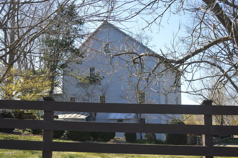

Why it's listed
This boundary increase adds a 32.33-acre parcel beside the Hanger Mill near Churchville, Augusta County, Virginia. The parcel holds the mill's tailrace, a channel that once carried water away from the mill wheel. Near the mill the race is lined with coursed stone walls for about 125 feet, then becomes a shallow channel with sloping earthen banks and trees as it crosses open fields. Two modern features, a road bridge over the race and a windmill, do not contribute. The tailrace matters because it was integral to the c. 1860 mill, which ground flour and other grains for local farmers until 1940. It is described as a rare surviving mid-nineteenth-century example that keeps its original location, setting and design apart from a roughly 14-foot section altered by the bridge. Deeds trace the land from the estate of Jacob Hanger in 1877 through several later owners.
Significance in brief: The tailrace is directly tied to the c. 1860 Hanger Mill and its flour and grain production, so it is proposed as a contributing resource under Criteria A and C. It is described as an intact and rare surviving mid-nineteenth-century tailrace. It retains a high degree of integrity despite a small alteration where a road bridge crosses it.
Machine-generated summary. This summary was generated by a language model from the official nomination document and has not been reviewed line by line by an editor. It may contain errors. Check the source document before relying on any detail. Source: nomination document (PDF) · National Archives catalog entry. NRHP reference 12001265, listed February 5, 2013. Summary generated October 2026 (model claude-sonnet-5-5, prompt v1.0-2026-10-29, confidence medium).
Key facts
| Address | Jct. of VA 801 & US 250, Churchville |
|---|---|
| County | Augusta County |
| Listed | February 5, 2013 |
| Reference number | 12001265 |
| Resource type | Structure |
| Period of significance | c. 1860-1940 |
| Criteria |
|
| Areas of significance | Industry |
| Level of significance | Local |
| Status (as stated in the nomination) | Current function is listed as vacant/not in use; the parcel is used as fallow and active agricultural fields. The tailrace has stone walls on one section and earthen banks lined with trees on another. |
| Acreage | 32.3 |
| Coordinates | 38.22154, -79.13349 (NPS GIS) |
What listing means for this property
For an income-producing building, listing (individually or as a contributing building in a district) is the gateway to the 20% federal rehabilitation tax credit on qualified rehabilitation costs, often stackable with state credits. Work claiming the credit must follow the Secretary of the Interior's Standards and be approved in advance.
Listing does not restrict a private owner acting without federal money or permits; where federal funding or licensing is involved, Section 106 review applies.
Noted as vacant in the nomination. Nomination documents can be decades old; current status may differ. If you are considering buying an empty listed property, read the due-diligence checklist.
General information, not legal or tax advice. Rules change; confirm with your State Historic Preservation Office or a qualified adviser.
Sources and further reading
- National Park Service, National Register of Historic Places database (snapshot May 2026), reference 12001265.
- Nomination form (PDF, National Archives) — catalog entry
- Wikipedia article (used for cross-checking only; text not reproduced here)
- Wikidata Q14712456
- This listing as JSON
Last updated October 2026. Found an error? See the editorial policy for how to report it.