West Line Historic District
Also known as: Raymond Heights; Raymond Plateau; Shelley Heights

Why it's listed
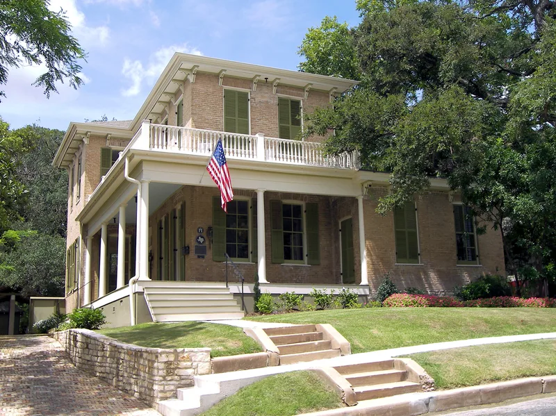
Spread across about 90 blocks on a bluff west of Shoal Creek in central Austin, this district grew from the large estates of James H. Raymond, an early state treasurer, into a streetcar suburb. More than twenty-five subdivisions were platted between 1871 and 1948. The W. Sixth Street streetcar line, called the West Line, drew most of the growth, which peaked between 1910 and 1930 when affordable bungalows were built for middle and working-class families. Of 984 resources, 638 contribute to the district's character. Craftsman and Classical Revival-influenced bungalows dominate, but Queen Anne houses, stone L-plan homes, Tudor Revival houses, Moderne apartments and later Ranch houses also appear. Landmarks include the castellated 1870 Texas Military Institute building, the 1916 Mathews School and the Treaty Oak. Small shops along W. Sixth Street and West Lynn still serve the neighborhood. The district was recognized for its cohesive streetscapes and its record of a century of suburban development.
Significance in brief: The district shows a century of continuous suburban development in West Austin, shaped by the W. Sixth Street streetcar line known as the West Line. Its greatest growth came in the 1910s-30s, producing many Craftsman and Classical Revival-influenced bungalows alongside earlier estates and institutional buildings. It retains a high degree of integrity and cohesive streetscapes.
Machine-generated summary. This summary was generated by a language model from the official nomination document and has not been reviewed line by line by an editor. It may contain errors. Check the source document before relying on any detail. Source: nomination document (PDF) · National Archives catalog entry. NRHP reference 05001166, listed October 12, 2005. Summary generated October 2026 (model claude-sonnet-5-5, prompt v1.0-2026-10-29, confidence medium).
Key facts
| Address | Roughly bounded by Baylor St., W. Fifth and Sixth Sts., MoPac Expressway, Austin |
|---|---|
| County | Travis County |
| Listed | October 12, 2005 |
| Reference number | 05001166 |
| Resource type | District |
| Period of significance | c.1865-1955 |
| Architect / builder | Nick Dawson (builder of stone L-plan houses in the Silliman Subdivision) |
| Architectural style | Late Victorian (Queen Anne, Folk Victorian, Italianate); Late 19th and 20th Century Revivals; Bungalow/Craftsman; Prairie School; Moderne, International Style, Ranch Style; Minimal Traditional |
| Areas of significance | Community Planning and Development, Architecture |
| Level of significance | Local |
| Status (as stated in the nomination) | Still used for single and multi-family dwellings, commercial, educational and civic purposes; 638 contributing and 346 noncontributing resources. |
| Acreage | 236 |
| Coordinates | 30.27849, -97.76000 (NPS GIS) |
What listing means for this property
This is a historic district. Buildings within its boundary are either contributing (they add to the district's significance) or non-contributing. Owners of contributing income-producing buildings can claim the 20% federal rehabilitation tax credit; homeowners should look at state credits. National Register districts impose no design review by themselves; a local historic district ordinance, if one exists, does (the difference explained).
General information, not legal or tax advice. Rules change; confirm with your State Historic Preservation Office or a qualified adviser.
Sources and further reading
- National Park Service, National Register of Historic Places database (snapshot May 2026), reference 05001166.
- Nomination form (PDF, National Archives) — catalog entry
- Wikipedia article (used for cross-checking only; text not reproduced here)
- Wikidata Q7985767
- This listing as JSON
Last updated October 2026. Found an error? See the editorial policy for how to report it.