Big Bend Historical Area

Why it's listed
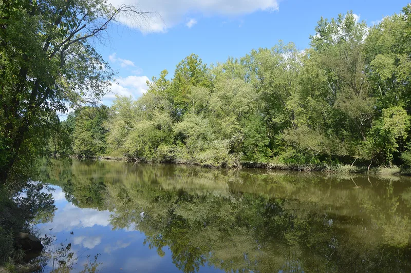
Along a sharp right-angle bend of the Shenango River in Mercer County, Pennsylvania, this 19th-century district preserves the site of the Village of Big Bend, a canal-era industrial community. The Big Bend Iron Furnace was founded in 1846 by McFarland and King, and on 1 April 1850 the partners opened a foundry attached to the blast furnace. Its castings were exchanged for wheat, rye, corn, oats and bacon, and all shipments moved by canal. The village had a canal loading wharf that served the charcoal furnaces of central Mercer County, and many of its residents worked on the canal or at the furnace and stove foundry. The furnace was abandoned in 1860 after mineral coal made it unprofitable. Visible remains today include the furnace site, the canal towpath, a loading bay, a hauling road, and the ruins of Dam No. 2 with a lock and lockkeeper's house. The site is significant for its link to early iron production and canal transportation.
Significance in brief: The nomination argues the village was one of the most industrialized towns along the Shenango Division of the Erie Extension Canal, and that the big bend was the location of one of the pioneer iron works in the United States. The Big Bend Iron Furnace, founded in 1846, was tied to the canal for shipping and was abandoned in 1860 when it became unprofitable. The area's visible remains illustrate canal-era transportation and industry.
Machine-generated summary. This summary was generated by a language model from the official nomination document and has not been reviewed line by line by an editor. It may contain errors. Check the source document before relying on any detail. Source: nomination document (PDF) · National Archives catalog entry. NRHP reference 75001654, listed April 21, 1975. Summary generated October 2026 (model claude-haiku-5-5, prompt v1.1-2026-10-29, confidence medium).
Key facts
| Address | 6 mi. NW of Mercer on Shenango River, Mercer |
|---|---|
| County | Mercer County |
| Listed | April 21, 1975 |
| Reference number | 75001654 |
| Resource type | District |
| Period of significance | 1830-1860 |
| Criteria |
|
| Areas of significance | Industry, Transportation, Exploration/Settlement |
| Level of significance | Local |
| Status (as stated in the nomination) | Ruins; the town site has no visible remains of buildings and was believed abandoned before the 1940s. |
| Acreage | 204 |
| Coordinates | 41.29252, -80.32638 (NPS GIS) |
What listing means for this property
This is a historic district. Buildings within its boundary are either contributing (they add to the district's significance) or non-contributing. Owners of contributing income-producing buildings can claim the 20% federal rehabilitation tax credit; homeowners should look at state credits. National Register districts impose no design review by themselves; a local historic district ordinance, if one exists, does (the difference explained).
General information, not legal or tax advice. Rules change; confirm with your State Historic Preservation Office or a qualified adviser.
Sources and further reading
- National Park Service, National Register of Historic Places database (snapshot May 2026), reference 75001654.
- Nomination form (PDF, National Archives) — catalog entry
- Wikipedia article (used for cross-checking only; text not reproduced here)
- Wikidata Q4905095
- This listing as JSON
Last updated October 2026. Found an error? See the editorial policy for how to report it.