Biery's Port Historic District
Also known as: Catasauqua

Why it's listed
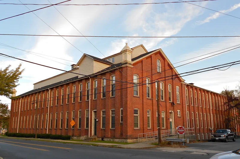
Biery's Port is a dense cluster of mid to late nineteenth century houses, shops and industrial buildings in the southern quarter of Catasauqua, on a slope running down to Catasauqua Creek. Its oldest houses are stone Federal-style dwellings built by Frederick Biery between 1801 and 1825 along Race Street. The district began with a grist mill erected by David Desher about 1852 at the confluence of the creek and the Lehigh River, which Biery later acquired in 1801. After the Lehigh Canal was built through the settlement around 1830, Biery added a tavern and a home near a chain bridge across the Lehigh, and the place took the name Biery's Port. The district became the commercial heart of the town as the anthracite iron industry developed nearby in the 1840s and 1850s. Most buildings are two to two-and-one-half stories, brick or wood frame, and retain much of their nineteenth-century character.
Significance in brief: The district is regarded as the oldest part of Catasauqua and an early home of the anthracite iron industry in America. Its buildings include some of the town's first residential and commercial structures, and it remained the town's commercial core into the late nineteenth and early twentieth centuries. The nomination also points to its early mill, ferry, canal-era tavern and bridge as the basis of its local importance.
Machine-generated summary. This summary was generated by a language model from the official nomination document and has not been reviewed line by line by an editor. It may contain errors. Check the source document before relying on any detail. Source: nomination document (PDF) · National Archives catalog entry. NRHP reference 84003457, listed August 9, 1984. Summary generated October 2026 (model claude-haiku-5-5, prompt v1.1-2026-10-29, confidence medium).
Key facts
| Address | Roughly bounded by Pineapple, Front, Race, and Mulberry Sts., Catasauqua |
|---|---|
| County | Lehigh County |
| Listed | August 9, 1984 |
| Reference number | 84003457 |
| Resource type | District |
| Architectural style | Federal; Italianate; Second Empire |
| Criteria |
|
| Areas of significance | Industry, Commerce, Exploration/Settlement |
| Level of significance | Local |
| Status (as stated in the nomination) | Altered; limited aluminum siding and brick coating, and new roofs; much of the nineteenth-century character is retained |
| Acreage | 21 |
| Coordinates | 40.64965, -75.46955 (NPS GIS) |
What listing means for this property
This is a historic district. Buildings within its boundary are either contributing (they add to the district's significance) or non-contributing. Owners of contributing income-producing buildings can claim the 20% federal rehabilitation tax credit; homeowners should look at state credits. National Register districts impose no design review by themselves; a local historic district ordinance, if one exists, does (the difference explained).
General information, not legal or tax advice. Rules change; confirm with your State Historic Preservation Office or a qualified adviser.
Sources and further reading
- National Park Service, National Register of Historic Places database (snapshot May 2026), reference 84003457.
- Nomination form (PDF, National Archives) — catalog entry
- Wikipedia article (used for cross-checking only; text not reproduced here)
- Wikidata Q4904645
- This listing as JSON
Last updated October 2026. Found an error? See the editorial policy for how to report it.