Manheim Borough Historic District

Why it's listed
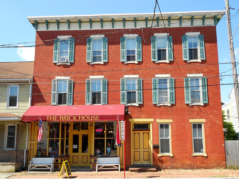
Manheim Borough is a small town in northwest Lancaster County, Pennsylvania, laid out on a grid around Market Square, with Main Street and High Street meeting at its center. Henry William Stiegel, a German immigrant ironmaster, established a glassworks there in 1765, and the town grew from a village of craftsmen into an industrial and commercial center. The district's buildings date from 1762 to 1949, with most built between 1860 and 1930. Mid-to-late nineteenth century buildings include Italianate and Eastlake houses, Second Empire residences, and combined store-and-residence buildings such as the Kready Store, built about 1865 to 1875. The Eisenlohr cigar factory, the Hershey Machine and Foundry Company, and the Noggle clothing factory show the role of manufacturing. The district is listed for its commercial, industrial and architectural significance.
Significance in brief: The nomination argues the district is significant under criteria A and C for commerce, industry and architecture. It developed from a glassworks founded by Henry William Stiegel in 1765 into an industrial and commercial center, and it holds a large concentration of mid-to-late nineteenth century buildings in several styles.
Machine-generated summary. This summary was generated by a language model from the official nomination document and has not been reviewed line by line by an editor. It may contain errors. Check the source document before relying on any detail. Source: nomination document (PDF) · National Archives catalog entry. NRHP reference 00000058, listed February 4, 2000. Summary generated October 2026 (model claude-haiku-5-5, prompt v1.1-2026-10-29, confidence medium).
Key facts
| Address | Roughly bounded by Colebrook, Laurel, Fuller Dr., And Fulton Sts., Manheim Borough |
|---|---|
| County | Lancaster County |
| Listed | February 4, 2000 |
| Reference number | 00000058 |
| Resource type | District |
| Period of significance | 1762-1949 |
| Architectural style | Italianate, Stick/Eastlake, Second Empire, Renaissance Revival, Bungalow, American Four-square |
| Criteria |
|
| Areas of significance | Commerce, Industry, Architecture |
| Level of significance | Local |
| Acreage | 230 |
| Coordinates | 40.16101, -76.39521 (NPS GIS) |
What listing means for this property
This is a historic district. Buildings within its boundary are either contributing (they add to the district's significance) or non-contributing. Owners of contributing income-producing buildings can claim the 20% federal rehabilitation tax credit; homeowners should look at state credits. National Register districts impose no design review by themselves; a local historic district ordinance, if one exists, does (the difference explained).
General information, not legal or tax advice. Rules change; confirm with your State Historic Preservation Office or a qualified adviser.
Sources and further reading
- National Park Service, National Register of Historic Places database (snapshot May 2026), reference 00000058.
- Nomination form (PDF, National Archives) — catalog entry
- Wikipedia article (used for cross-checking only; text not reproduced here)
- Wikidata Q6749333
- This listing as JSON
Last updated October 2026. Found an error? See the editorial policy for how to report it.