Evans, Ann Cunningham, House

Why it's listed
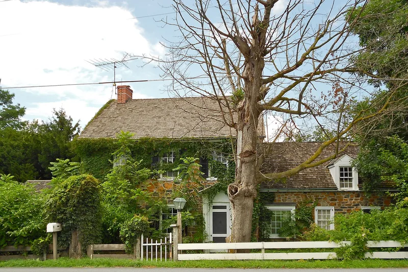
Built around 1814 in Beartown, a crossroads village in Caernarvon Township, Lancaster County, this two-and-a-half story ironstone house has three bays, a side hall plan and a gable roof. Ann Cunningham Evans, widow of James Evans, had it constructed on a one-acre lot she bought from her neighbor Cyrus Jacobs for $300. The south elevation carries a punch and gouge carved wooden cornice, and the interior has attenuated stair balusters, carved stair brackets, reeded trim and a gouge carved mantel. The house is regarded as an unusually refined example of Federal design for eastern Lancaster County, where most farmhouses of the period show little decoration. A rear ell of the same date and a 1930 sunroom and a 1950-1951 east addition with a garage and kitchen are set back from the main facade and built in matching materials.
Significance in brief: The nomination argues the house is a locally significant example of Federal style architecture, with a punch and gouge carved wooden cornice, Federal interior woodwork and stair, and a three-bay side hall plan. It is described as unusually high in Federal detailing for the township, and its rear ell and two twentieth-century side additions are presented as sympathetic to the original character.
Machine-generated summary. This summary was generated by a language model from the official nomination document and has not been reviewed line by line by an editor. It may contain errors. Check the source document before relying on any detail. Source: nomination document (PDF) · National Archives catalog entry. NRHP reference 02000475, listed May 9, 2002. Summary generated October 2026 (model claude-haiku-5-5, prompt v1.1-2026-10-29, confidence medium).
Key facts
| Address | 6132 Twenty-eighth Division Hwy., Caernarvon |
|---|---|
| County | Lancaster County |
| Listed | May 9, 2002 |
| Reference number | 02000475 |
| Resource type | Site |
| Period of significance | c. 1814 |
| Architectural style | Early Republic: Federal |
| Criteria |
|
| Areas of significance | Architecture |
| Level of significance | Local |
| Acreage | 1.1 |
| Coordinates | 40.11236, -75.98297 (NPS GIS) |
What listing means for this property
Sites (archaeological sites, battlefields, landscapes) are often listed with a restricted address to protect them from looting or disturbance. Listing is honorary for private owners; federal undertakings on or near the site go through Section 106 review, and state laws may protect burials and artefacts regardless of listing.
General information, not legal or tax advice. Rules change; confirm with your State Historic Preservation Office or a qualified adviser.
Sources and further reading
- National Park Service, National Register of Historic Places database (snapshot May 2026), reference 02000475.
- Nomination form (PDF, National Archives) — catalog entry
- Wikipedia article (used for cross-checking only; text not reproduced here)
- Wikidata Q4766344
- This listing as JSON
Last updated October 2026. Found an error? See the editorial policy for how to report it.