Brier Hill
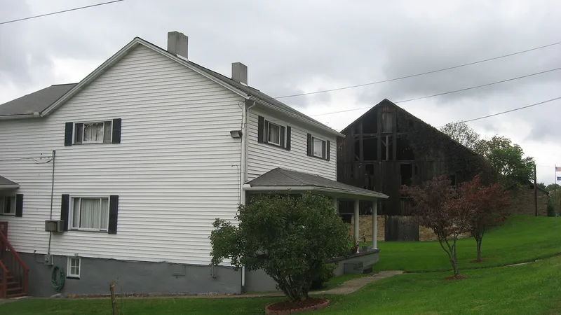

Why it's listed
Brier Hill is a coal mining district in Fayette County, Pennsylvania, whose mining buildings were largely built between 1902 and 1904. The district includes five double company houses, a group of sandstone mining buildings with slate roofs, and about 75 of an original 600 brick beehive coking ovens. The company houses have sandstone foundations, coal-burning heating stoves and separate yards, a layout unusual for company towns of the period. The mine was about 700 feet deep, reportedly the deepest bituminous coal mine in Pennsylvania, and it closed in 1936 after water flooded the workings faster than it could be pumped out. The coke it produced supplied blast furnaces of the Brier Hill Steel Company in Ohio. The district is regarded as a well-preserved example of a company-owned coal town and its mining complex.
Significance in brief: The district is regarded as an important example of a company-owned coal mining town of the late 1800s and early 1900s, with well-preserved double houses and mining buildings. The mine, reported to be 700 feet deep and the deepest bituminous coal mine in Pennsylvania, closed in 1936 when water flooded it. The coking operations that supplied the nearby blast furnaces are also cited as part of the development of coal and coke technology in Pennsylvania.
Machine-generated summary. This summary was generated by a language model from the official nomination document and has not been reviewed line by line by an editor. It may contain errors. Check the source document before relying on any detail. Source: nomination document (PDF) · National Archives catalog entry. NRHP reference 73001629, listed July 2, 1973. Summary generated October 2026 (model claude-haiku-5-5, prompt v1.1-2026-10-29, confidence medium).
Key facts
| Address | On U.S. 40, Brier Hill |
|---|---|
| County | Fayette County |
| Listed | July 2, 1973 |
| Reference number | 73001629 |
| Resource type | District |
| Period of significance | 1902-04 |
| Areas of significance | Industry, Architecture |
| Level of significance | State |
| Status (as stated in the nomination) | The company houses are inhabited or were lived in until 1972; eight mining buildings remain standing, with deteriorating roofs. |
| Acreage | 45 |
| Coordinates | 39.97959, -79.82997 (NPS GIS) |
What listing means for this property
This is a historic district. Buildings within its boundary are either contributing (they add to the district's significance) or non-contributing. Owners of contributing income-producing buildings can claim the 20% federal rehabilitation tax credit; homeowners should look at state credits. National Register districts impose no design review by themselves; a local historic district ordinance, if one exists, does (the difference explained).
General information, not legal or tax advice. Rules change; confirm with your State Historic Preservation Office or a qualified adviser.
Sources and further reading
- National Park Service, National Register of Historic Places database (snapshot May 2026), reference 73001629.
- Nomination form (PDF, National Archives) — catalog entry
- Wikipedia article (used for cross-checking only; text not reproduced here)
- Wikidata Q4967060
- This listing as JSON
Last updated October 2026. Found an error? See the editorial policy for how to report it.