Fricks Locks Historic District

Why it's listed
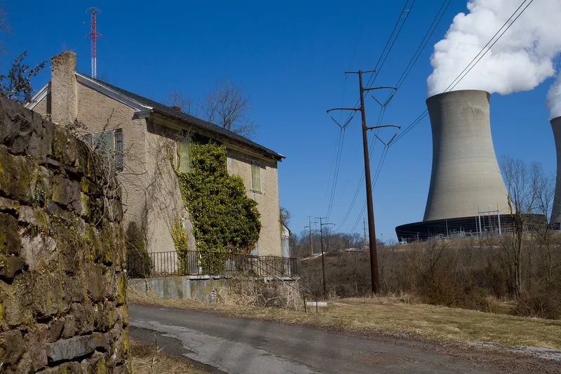
Fricks Locks is a canal village on the Girard Reach of the Schuylkill River Canal in East Coventry Township, Chester County, Pennsylvania. Its twin locks, built in 1824 beside a lockkeeper's house and a general store, were the center of a small settlement on land held by the Frick family. The Schuylkill Navigation Company built the locks, which were enlarged in 1834 and 1846 to accommodate larger coal barges. The district contains dwellings dating from 1757 onward, including a stone house from 1757 and a Federal-style stone manor house remodelled in 1854. Elhanan Frick's store, opened in the 1840s, served farmers and boatmen with feed, coal, lumber and groceries. The canal carried coal and merchandise until its closure in 1930. The district is listed for its ties to canal transportation and for its rural vernacular buildings, which remain largely intact from the village's operating years.
Significance in brief: The nomination argues the village is significant for its association with the development of the Schuylkill Navigation Canal, which it links to transportation history. It also argues the district is locally significant for its rural vernacular architecture from the eighteenth and nineteenth centuries, and that it remains largely intact as a canal village.
Machine-generated summary. This summary was generated by a language model from the official nomination document and has not been reviewed line by line by an editor. It may contain errors. Check the source document before relying on any detail. Source: nomination document (PDF) · National Archives catalog entry. NRHP reference 03001188, listed November 21, 2003. Summary generated October 2026 (model claude-haiku-5-5, prompt v1.1-2026-10-29, confidence medium).
Key facts
| Address | End of Fricks Lock Rd., approx. 1000 ft. E. of Sanatoga Rd. (East Coventry Township), Pottstown |
|---|---|
| County | Chester County |
| Listed | November 21, 2003 |
| Reference number | 03001188 |
| Resource type | District |
| Period of significance | 1757-1930 |
| Architectural style | Federal |
| Criteria |
|
| Areas of significance | Transportation, Architecture |
| Level of significance | Local |
| Status (as stated in the nomination) | The locks were filled after 1930 and the canal is no longer in operation; a large barn and silo were taken down in 1998. |
| Acreage | 18 |
| Coordinates | 40.22129, -75.59608 (NPS GIS) |
What listing means for this property
This is a historic district. Buildings within its boundary are either contributing (they add to the district's significance) or non-contributing. Owners of contributing income-producing buildings can claim the 20% federal rehabilitation tax credit; homeowners should look at state credits. National Register districts impose no design review by themselves; a local historic district ordinance, if one exists, does (the difference explained).
General information, not legal or tax advice. Rules change; confirm with your State Historic Preservation Office or a qualified adviser.
Sources and further reading
- National Park Service, National Register of Historic Places database (snapshot May 2026), reference 03001188.
- Nomination form (PDF, National Archives) — catalog entry
- Wikipedia article (used for cross-checking only; text not reproduced here)
- Wikidata Q5503408
- This listing as JSON
Last updated October 2026. Found an error? See the editorial policy for how to report it.