Elverson Historic District
Also known as: Springfield

Why it's listed
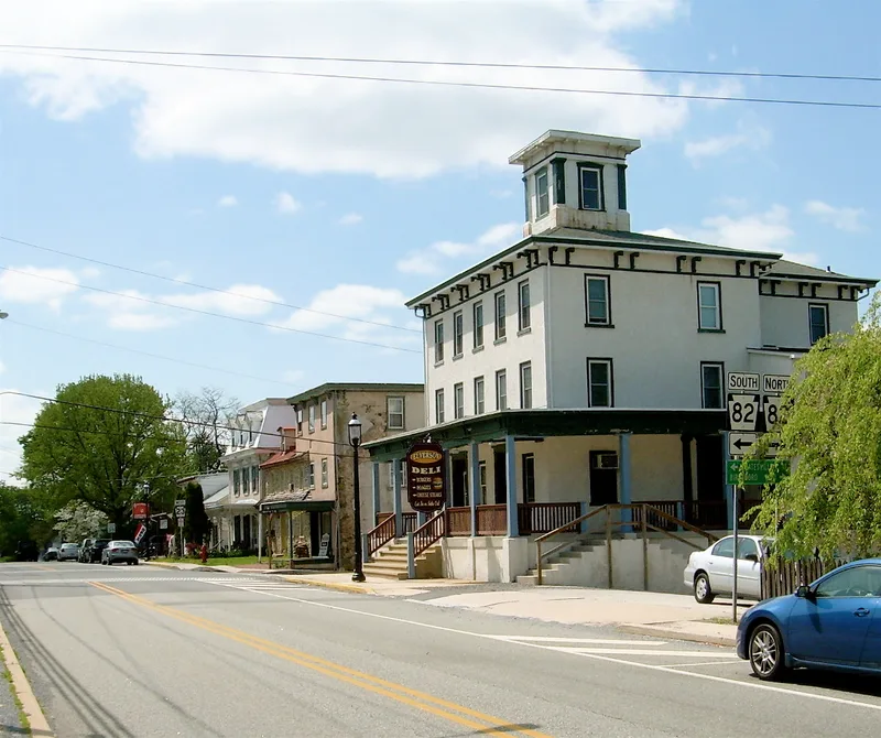
Elverson is the highest borough in Chester County, lying at about 870 feet above sea level. Its historic district holds roughly eighty-one contributing dwellings and fourteen commercial and public buildings, mostly stone or frame, arranged along Main and Chestnut Streets. The earliest surviving buildings date from around 1750, including stone bank houses, and the village grew up around springs on the Blue Rock Path, a trade route toward iron furnaces. The commercial core developed after the Wilmington and Northern Railroad arrived in 1870, bringing a hotel, a freight house, a coal and lumber yard and a creamery. The district is regarded as a microcosm of local architectural change, moving from eighteenth-century vernacular houses through Italianate, Second Empire and Queen Anne buildings to American Four Square and bungalow houses of the 1910s and 1920s. Its growth halted around 1930, which leaves the historic fabric largely intact.
Significance in brief: The district is argued to be a well preserved, representative example of mid-eighteenth to early twentieth century architecture in northwestern Chester County, showing the village's evolution from vernacular stone buildings to Victorian and bungalow styles. It is also significant for commerce as the principal commercial center of the surrounding northwestern Chester County townships up to 1930.
Machine-generated summary. This summary was generated by a language model from the official nomination document and has not been reviewed line by line by an editor. It may contain errors. Check the source document before relying on any detail. Source: nomination document (PDF) · National Archives catalog entry. NRHP reference 93000354, listed April 29, 1993. Summary generated October 2026 (model claude-haiku-5-5, prompt v1.1-2026-10-29, confidence high).
Key facts
| Address | Main, Chestnut and Hall Sts. and Park Ave., Elverson |
|---|---|
| County | Chester County |
| Listed | April 29, 1993 |
| Reference number | 93000354 |
| Resource type | District |
| Period of significance | 1750-1930 |
| Architectural style | Colonial/Georgian; Late Victorian/Gothic; Late 19th & Early 20th C. American Movement, Bungalow/Craftsman; vernacular |
| Criteria |
|
| Areas of significance | Commerce, Architecture |
| Level of significance | Local |
| Status (as stated in the nomination) | The district has good integrity; most contributing buildings have been carefully preserved, and the Dampman hotel building and Zook-era commercial buildings continue in use, while one former car dealership is noted as presently vacant. |
| Acreage | 61 |
| Coordinates | 40.15643, -75.83186 (NPS GIS) |
What listing means for this property
This is a historic district. Buildings within its boundary are either contributing (they add to the district's significance) or non-contributing. Owners of contributing income-producing buildings can claim the 20% federal rehabilitation tax credit; homeowners should look at state credits. National Register districts impose no design review by themselves; a local historic district ordinance, if one exists, does (the difference explained).
General information, not legal or tax advice. Rules change; confirm with your State Historic Preservation Office or a qualified adviser.
Sources and further reading
- National Park Service, National Register of Historic Places database (snapshot May 2026), reference 93000354.
- Nomination form (PDF, National Archives) — catalog entry
- Wikipedia article (used for cross-checking only; text not reproduced here)
- Wikidata Q5368019
- This listing as JSON
Last updated October 2026. Found an error? See the editorial policy for how to report it.