Westmont Historic District
Also known as: Old Westmont

Why it's listed
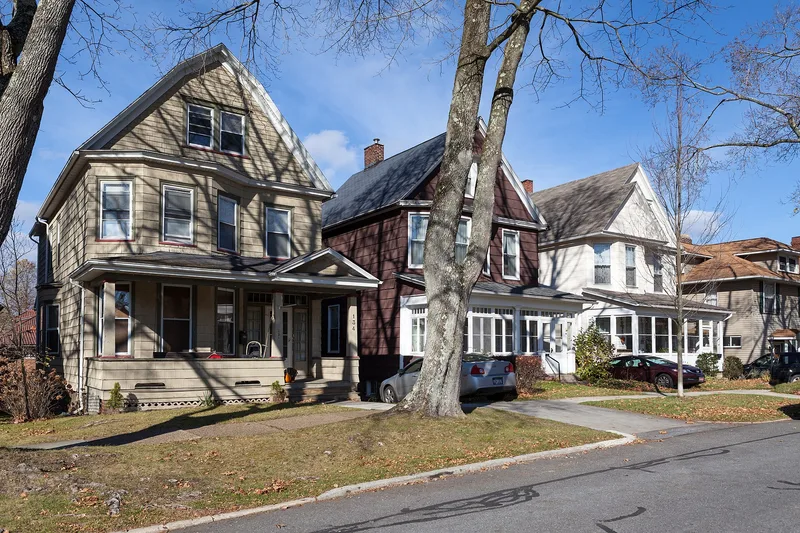
Old Westmont is a residential district on a hilltop plateau above Johnstown, laid out from 1889 by the Cambria Iron Company as a model suburb for its workers and managers. The company bought more than 500 acres on Yoder Hill, built the Inclined Plane for access from downtown, and had Philadelphia landscape architects Miller and Yates design a gridded street plan with a tree-lined boulevard on Luzerne Street. Its housing ranges from large houses for executives along Luzerne, Tioga and Bucknell streets to modest single and double houses elsewhere, with a clear division between white-collar and blue-collar sections. The district is valued for its concentration of late nineteenth and early twentieth century residences, a wide variety of styles, and a high degree of surviving architectural integrity. Architects Walter Myton and Henry Moore Rogers designed a number of its homes.
Significance in brief: The district is argued to be the largest company neighborhood sponsored by the Cambria Iron Company and a planned suburb with company-financed infrastructure. It is also presented as Greater Johnstown's densest concentration of late nineteenth and early twentieth century residences, with an unusually wide range of architectural styles and high integrity.
Machine-generated summary. This summary was generated by a language model from the official nomination document and has not been reviewed line by line by an editor. It may contain errors. Check the source document before relying on any detail. Source: nomination document (PDF) · National Archives catalog entry. NRHP reference 95000131, listed February 24, 1995. Summary generated October 2026 (model claude-haiku-5-5, prompt v1.1-2026-10-29, confidence high).
Key facts
| Address | Roughly bounded by Clarion St., Edgehill Dr., Blair and Wayne Sts., Diamond Blvd. and Stackhouse Park, Westmont |
|---|---|
| County | Cambria County |
| Listed | February 24, 1995 |
| Reference number | 95000131 |
| Resource type | District |
| Period of significance | 1889-1944 |
| Architect / builder | Walter R. Myton (architect); Henry M. Rogers (architect); Miller and Yates (landscape architects) |
| Architectural style | Colonial Revival; Bungalow/Craftsman; Prairie School; Queen Anne; Arts and Crafts; Second Empire; Shingle; Eastlake; Spanish Villa; Tudor Revival; International |
| Criteria |
|
| Areas of significance | Community Planning and Development, Architecture, Industry |
| Level of significance | Local |
| Acreage | 86 |
| Coordinates | 40.32702, -78.95891 (NPS GIS) |
What listing means for this property
This is a historic district. Buildings within its boundary are either contributing (they add to the district's significance) or non-contributing. Owners of contributing income-producing buildings can claim the 20% federal rehabilitation tax credit; homeowners should look at state credits. National Register districts impose no design review by themselves; a local historic district ordinance, if one exists, does (the difference explained).
General information, not legal or tax advice. Rules change; confirm with your State Historic Preservation Office or a qualified adviser.
Sources and further reading
- National Park Service, National Register of Historic Places database (snapshot May 2026), reference 95000131.
- Nomination form (PDF, National Archives) — catalog entry
- Wikipedia article (used for cross-checking only; text not reproduced here)
- Wikidata Q7989253
- This listing as JSON
Last updated October 2026. Found an error? See the editorial policy for how to report it.