Upper Aquetong Valley Historic District
Also known as: Meeting House Road; See also:Honey Hollow Watershed NHL

Why it's listed
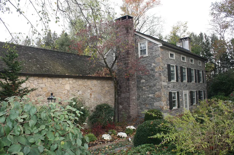
Set in the western part of Solebury Township, the Upper Aquetong Valley is a rural district of about 1,300 acres made up of dispersed farmsteads along Meetinghouse Road and the upper Aquetong Creek. Most of its buildings are random fieldstone houses, bank barns, springhouses and smokehouses from the late eighteenth and nineteenth centuries, and most farm parcels keep the boundaries shown on nineteenth century county maps. The district is significant as an example of the dispersed settlement pattern that Quaker families established in southeastern Pennsylvania, with houses set back among fields and tree lines rather than gathered in a village. Its agriculture combined grain and livestock, and lime quarrying and kilns, along with a tannery, supplied a second source of income. The Solebury Meeting House, built in 1806, and the Federal-style John Blackfan House of about 1836 are the most formal buildings in the valley. The surrounding land has changed little, which keeps the historic settlement pattern readable.
Significance in brief: The nomination argues the district is an outstanding, high-integrity assemblage of late eighteenth and nineteenth century farms that illustrates the dispersed Quaker pattern of agricultural settlement in southeastern Pennsylvania. It also represents vernacular Georgian and Federal-influenced farm architecture and a limestone-quarrying and lime-burning economy that supported the farms.
Machine-generated summary. This summary was generated by a language model from the official nomination document and has not been reviewed line by line by an editor. It may contain errors. Check the source document before relying on any detail. Source: nomination document (PDF) · National Archives catalog entry. NRHP reference 87001216, listed July 30, 1987. Summary generated October 2026 (model claude-haiku-5-5, prompt v1.1-2026-10-29, confidence medium).
Key facts
| Address | Meeting House and Aquetong Rds., between US 202 and Sugan Rd., Solebury |
|---|---|
| County | Bucks County |
| Listed | July 30, 1987 |
| Reference number | 87001216 |
| Resource type | District |
| Period of significance | c. 1750-1900 |
| Architectural style | Vernacular, loosely based on Georgian and Federal styles |
| Criteria |
|
| Areas of significance | Agriculture, Exploration/Settlement, Architecture |
| Level of significance | Local |
| Status (as stated in the nomination) | Largely agricultural and rural, with most contributing buildings surviving and many parcels retaining nineteenth century boundaries; the form marks the resource as altered. |
| Acreage | 1275 |
| Coordinates | 40.36187, -75.00331 (NPS GIS) |
What listing means for this property
This is a historic district. Buildings within its boundary are either contributing (they add to the district's significance) or non-contributing. Owners of contributing income-producing buildings can claim the 20% federal rehabilitation tax credit; homeowners should look at state credits. National Register districts impose no design review by themselves; a local historic district ordinance, if one exists, does (the difference explained).
General information, not legal or tax advice. Rules change; confirm with your State Historic Preservation Office or a qualified adviser.
Sources and further reading
- National Park Service, National Register of Historic Places database (snapshot May 2026), reference 87001216.
- Nomination form (PDF, National Archives) — catalog entry
- Wikipedia article (used for cross-checking only; text not reproduced here)
- Wikidata Q7898461
- This listing as JSON
Last updated October 2026. Found an error? See the editorial policy for how to report it.