Old Dry Road
Also known as: Staudt Farm

Why it's listed
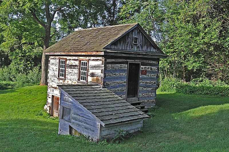
Near Wernersville in Berks County, the Staudt farmstead lies in a stream valley along the Tulpehocken Creek, reached by a lane about 2800 feet long from Highland Road. The complex includes a late 18th century log speicher built over a spring, a two-and-a-half story log house with an 18th century core, a stone smoke house, a corn crib, a pig sty and a bank barn dated 1901. The speicher was a multi-purpose outbuilding for keeping grain, cheese, meat and valuables, with a cool spring room below, a drying area on the second floor and a dry storage loft above. The farm is regarded as an intact example of the Pennsylvania Dutch farmstead, with its original buildings, orchard, meadow and fields still in their traditional positions. Its architectural and cultural value rests on the speicher and the preserved landscape, which together show farm practices from the 18th and 19th centuries.
Significance in brief: The nomination argues the farm preserves the characteristics of the Pennsylvania Dutch farmstead and its outbuildings, including a speicher that combined food storage with a spring house. It also cites the farm's intact traditional field, orchard, meadow and woodland pattern along the original settlement road, and its value for agricultural and educational use.
Machine-generated summary. This summary was generated by a language model from the official nomination document and has not been reviewed line by line by an editor. It may contain errors. Check the source document before relying on any detail. Source: nomination document (PDF) · National Archives catalog entry. NRHP reference 78002349, listed January 23, 1978. Summary generated October 2026 (model claude-haiku-5-5, prompt v1.1-2026-10-29, confidence medium).
Key facts
| Address | 3 mi. (4.8 km) NW of Wernersville on Highland Rd., Lower Heidelberg Township, Wernersville |
|---|---|
| County | Berks County |
| Listed | January 23, 1978 |
| Reference number | 78002349 |
| Resource type | Building |
| Architect / builder | Phillip Hase (1744) |
| Criteria |
|
| Areas of significance | Historic - Non-Aboriginal, Agriculture, Education, Architecture |
| Level of significance | Local |
| Status (as stated in the nomination) | The farm is to be preserved under a lease arrangement and restored as funds become available. |
| Acreage | 1.3 |
| Coordinates | 40.37395, -76.05791 (NPS GIS) |
What listing means for this property
National Register listing is honorary: it recognises significance and does not restrict what a private owner may do without federal money or permits. It unlocks the 20% federal rehabilitation tax credit for income-producing buildings, state credits in many states, and Section 106 review when federal agencies are involved. See what listing means in practice.
General information, not legal or tax advice. Rules change; confirm with your State Historic Preservation Office or a qualified adviser.
Sources and further reading
- National Park Service, National Register of Historic Places database (snapshot May 2026), reference 78002349.
- Nomination form (PDF, National Archives) — catalog entry
- Wikipedia article (used for cross-checking only; text not reproduced here)
- Wikidata Q7083875
- This listing as JSON
Last updated October 2026. Found an error? See the editorial policy for how to report it.