Marietta Historic District
Also known as: See Also:Rufus Putnam House; Ohio Company Land Office; Erwin H

Why it's listed
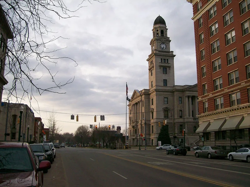
Marietta's historic district covers about 450 acres of flat river bottomland where the Muskingum meets the Ohio River in Washington County, Ohio. Forty-seven settlers sent by the Ohio Company of Associates landed here on April 7, 1788, and laid out a grid of unusually wide streets, with Washington Street at 120 feet. Public commons such as Sacra Via were set aside. The streets and parks survive today. The first years were spent inside the Campus Martius stockade, home to territorial officials including Governor Arthur St. Clair and General Rufus Putnam. The Campus Martius Museum now stands on part of that site and holds the original Ohio Company Land Office. Few original buildings remain, but many 19th-century ones do, including Federal, Greek Revival, Gothic Revival and Victorian examples along Front and Putnam Streets and in tree-lined residential blocks. The district is recognized as the first permanent settlement in the Northwest Territory.
Significance in brief: Marietta is considered the first permanent settlement in Ohio and the Northwest Territory, founded by the Ohio Company of Associates in 1788. The district keeps its original street layout and commons as parkland, and retains many buildings from the 19th century in Federal, Greek Revival, Gothic Revival and Victorian styles. It also contains sites tied to early territorial government, such as the Campus Martius site and the Ohio Company Land Office.
Machine-generated summary. This summary was generated by a language model from the official nomination document and has not been reviewed line by line by an editor. It may contain errors. Check the source document before relying on any detail. Source: nomination document (PDF) · National Archives catalog entry. NRHP reference 74001646, listed December 19, 1974. Summary generated October 2026 (model claude-sonnet-5-5, prompt v1.0-2026-10-29, confidence medium).
Key facts
| Address | Roughly bounded by the Muskingum and Ohio Rivers and Warren, 3rd, 5th, and 6th Sts., Marietta |
|---|---|
| County | Washington County |
| Listed | December 19, 1974 |
| Reference number | 74001646 |
| Resource type | District |
| Period of significance | 1788-1910 |
| Architectural style | Federal, Greek Revival, Gothic Revival and Victorian |
| Areas of significance | Industry, Prehistoric, Community Planning and Development, Landscape Architecture, Commerce, Military, Education, Politics/Government, Architecture, Religion |
| Level of significance | State |
| Status (as stated in the nomination) | Condition marked good and altered; the district is still occupied, with a business center on Putnam Street and residential areas to the north. |
| Acreage | 450 |
| Within district | Marietta Historic District (Boundary Increase) |
| Coordinates | 39.41788, -81.45521 (NPS GIS) |
What listing means for this property
This is a historic district. Buildings within its boundary are either contributing (they add to the district's significance) or non-contributing. Owners of contributing income-producing buildings can claim the 20% federal rehabilitation tax credit; homeowners should look at state credits. National Register districts impose no design review by themselves; a local historic district ordinance, if one exists, does (the difference explained).
General information, not legal or tax advice. Rules change; confirm with your State Historic Preservation Office or a qualified adviser.
Sources and further reading
- National Park Service, National Register of Historic Places database (snapshot May 2026), reference 74001646.
- Nomination form (PDF, National Archives) — catalog entry
- Wikipedia article (used for cross-checking only; text not reproduced here)
- Wikidata Q6763234
- This listing as JSON
Last updated October 2026. Found an error? See the editorial policy for how to report it.