Lock No. 28
Also known as: Deep Lock

Why it's listed
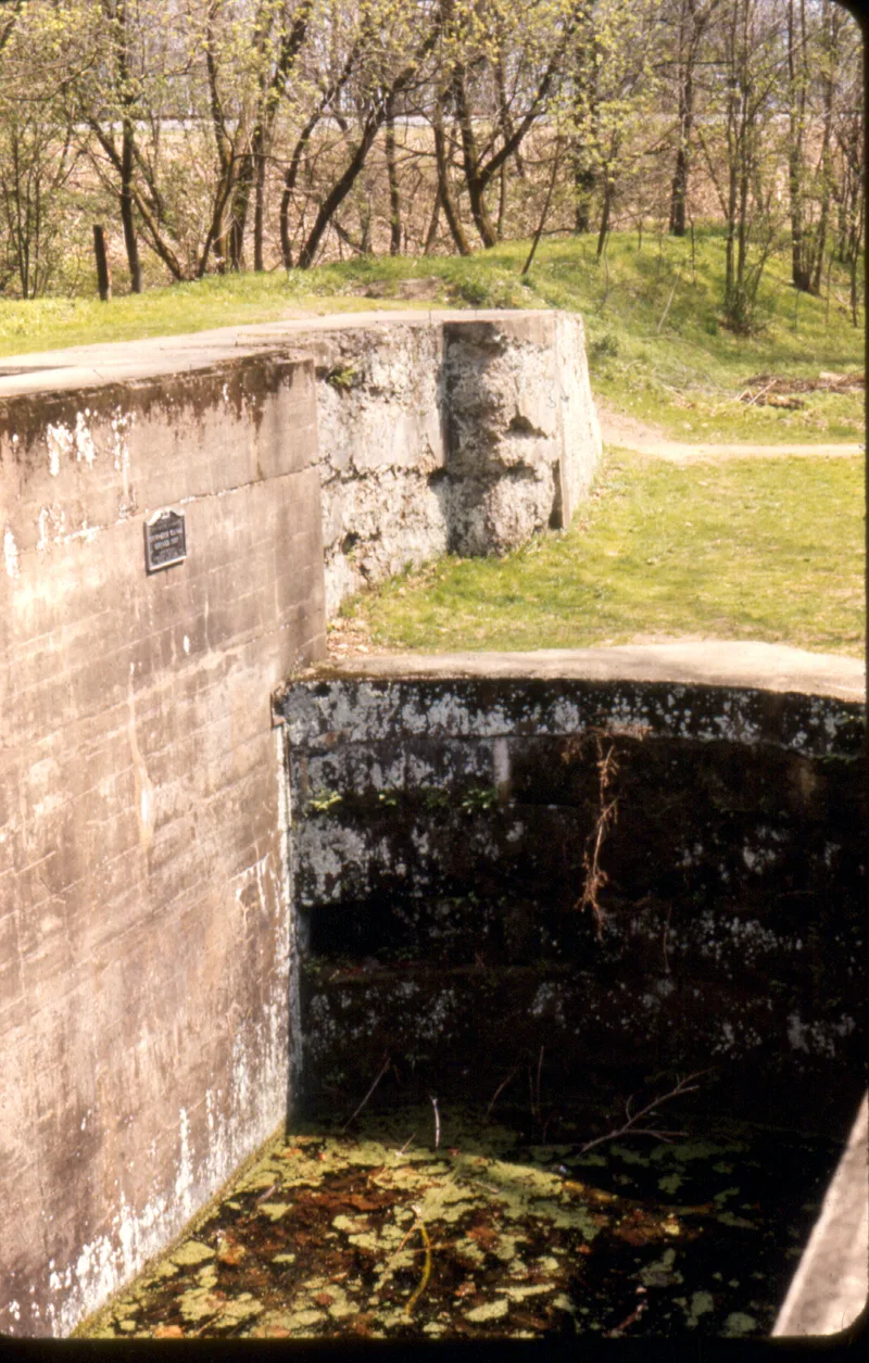
Lock No. 28, popularly called "Deep Lock," is a canal lock on the Ohio & Erie Canal at Peninsula, Summit County, Ohio. Built between 1825 and 1827, it is a standard mitered-gate lock of load-bearing masonry, faced in cut stone and concrete. Its chamber is 15 feet wide and 16 feet deep. That depth made it the deepest lock on the section of the canal between Akron and Cleveland, which is the source of its name. Like most other locks in the system, it was repaired with concrete around 1905. Both gates are now missing, though water remains in the chamber. The lock sits in carefully maintained park land within Deep Lock Quarry Metro Park, near the Old South Quarry. It is regarded as one of the best preserved locks in the Cuyahoga Valley, along with Locks No. 37-39 in Valley View. Its condition is recorded as very good, and the site is open to the public without restriction.
Significance in brief: At 16 feet deep, it was the deepest lock on the stretch of the Ohio & Erie Canal between Akron and Cleveland, which gave it the name "Deep Lock." Along with Locks No. 37-39 in Valley View, it is described as among the best preserved in the Cuyahoga Valley.
Machine-generated summary. This summary was generated by a language model from the official nomination document and has not been reviewed line by line by an editor. It may contain errors. Check the source document before relying on any detail. Source: nomination document (PDF) · National Archives catalog entry. NRHP reference 79000304, listed December 11, 1979. Summary generated October 2026 (model claude-sonnet-5-5, prompt v1.0-2026-10-29, confidence medium).
Key facts
| Address | Deep Lock Q Quarry Metro Park, Peninsula |
|---|---|
| County | Summit County |
| Listed | December 11, 1979 |
| Reference number | 79000304 |
| Resource type | Structure |
| Period of significance | 1825-1827 |
| Areas of significance | Commerce, Engineering, Transportation, Exploration/Settlement |
| Level of significance | State |
| Status (as stated in the nomination) | Listed in very good condition and now in park use. Both gates are missing, the chamber was repaired with concrete around 1905, and there is water in the chamber. |
| Acreage | 0.9 |
| Coordinates | 41.23281, -81.55230 (NPS GIS) |
What listing means for this property
National Register listing is honorary: it recognises significance and does not restrict what a private owner may do without federal money or permits. It unlocks the 20% federal rehabilitation tax credit for income-producing buildings, state credits in many states, and Section 106 review when federal agencies are involved. See what listing means in practice.
General information, not legal or tax advice. Rules change; confirm with your State Historic Preservation Office or a qualified adviser.
Sources and further reading
- National Park Service, National Register of Historic Places database (snapshot May 2026), reference 79000304.
- Nomination form (PDF, National Archives) — catalog entry
- Wikidata Q97994439
- This listing as JSON
Last updated October 2026. Found an error? See the editorial policy for how to report it.