Fort Recovery Site

Approximate location: the National Park Service places this pin arbitrarily within the property, not at a surveyed point (stated accuracy ±12 m).
Why it's listed
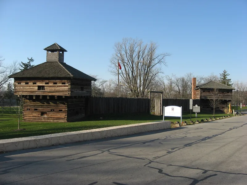
Fort Recovery Site, on Ohio Route 49 in Mercer County, preserves the ground where two significant frontier battles took place. On November 4, 1791, an army under General Arthur St. Clair suffered the worst defeat in its history at the hands of forces led by Little Turtle and Blue Jacket. Two years later General Anthony Wayne sent Major Henry Burbeck to build a strong fort on the spot. Its design had four blockhouses, each 20 feet square, joined by pickets, and a second story was later added to each. In 1794 an Indian army attacked the fort and a supply convoy, and the fighting ended on July 1. Wayne went on to win at Fallen Timbers and to witness the Treaty of Greeneville in 1795. No original structures survive, but two reproduction blockhouses, markers and a museum built in the 1930s remain. The site is owned by the State of Ohio and The Ohio Historical Society, open to the public, and serves as a memorial to both battles.
Significance in brief: The site marks two important battles of the Indian Wars in the Northwest Territory: St. Clair's defeat in 1791 and the 1794 attack on Wayne's fort. Both were important to the outcome of the wars in Ohio. The site serves as a memorial to the U.S. Armies under St. Clair and Wayne.
Machine-generated summary. This summary was generated by a language model from the official nomination document and has not been reviewed line by line by an editor. It may contain errors. Check the source document before relying on any detail. Source: nomination document (PDF) · National Archives catalog entry. NRHP reference 70000509, listed November 10, 1970. Summary generated October 2026 (model claude-sonnet-5-5, prompt v1.0-2026-10-29, confidence medium).
Key facts
| Address | OH 49, Fort Recovery |
|---|---|
| County | Mercer County |
| Listed | November 10, 1970 |
| Reference number | 70000509 |
| Resource type | Site |
| Period of significance | 18th Century (specific dates 1791 & 1793) |
| Architect / builder | Major Henry Burbeck, sent by General Anthony Wayne to construct the fort |
| Areas of significance | Military |
| Level of significance | State |
| Status (as stated in the nomination) | No original fort structures remain; two reproduction blockhouses, markers and a 1930s museum are present. The area is open to the public and administered by The Ohio Historical Society. |
| Acreage | 5 |
| Coordinates | 40.41402, -84.78081 (NPS GIS) |
What listing means for this property
Sites (archaeological sites, battlefields, landscapes) are often listed with a restricted address to protect them from looting or disturbance. Listing is honorary for private owners; federal undertakings on or near the site go through Section 106 review, and state laws may protect burials and artefacts regardless of listing.
General information, not legal or tax advice. Rules change; confirm with your State Historic Preservation Office or a qualified adviser.
Sources and further reading
- National Park Service, National Register of Historic Places database (snapshot May 2026), reference 70000509.
- Nomination form (PDF, National Archives) — catalog entry
- Wikipedia article (used for cross-checking only; text not reproduced here)
- Wikidata Q5471897
- This listing as JSON
Last updated October 2026. Found an error? See the editorial policy for how to report it.