Mound Cemetery Mound

Why it's listed
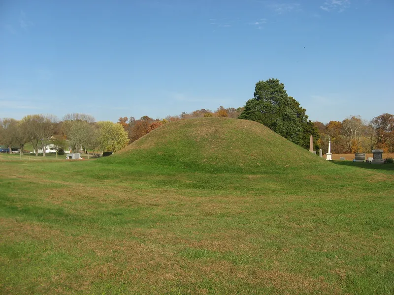
Near Chester in Meigs County, Ohio, a grass-covered earthen mound rises in the middle of a township cemetery beside Summer Road. It measures 54 feet across at the base and 11.7 feet high, and sits on a rise about 80 feet above the Middle Branch of the Shade River. The mound is probably the work of the Adena people, who lived in Ohio from about 1000 B.C. to A.D. 400, based on its symmetrical, subconical shape and its position near a tributary of a major river. It likely covers the log tomb of an individual of high political, social and religious standing, and a timber circular structure may once have stood on the spot. Plowed fields around the cemetery may have erased related features. Because it lies within a cemetery, the mound has escaped the damage common to many such sites, and it shows no signs of amateur digging. Its unusually good preservation is the main reason it was listed.
Significance in brief: The mound is thought to be an Adena construction because of its subconical, symmetrical shape and its hilltop location near a river tributary. It is unusually well preserved for an area where most archaeological work was done by amateurs. It likely covers a log tomb of a person of high status.
Machine-generated summary. This summary was generated by a language model from the official nomination document and has not been reviewed line by line by an editor. It may contain errors. Check the source document before relying on any detail. Source: nomination document (PDF) · National Archives catalog entry. NRHP reference 74001575, listed May 2, 1974. Summary generated October 2026 (model claude-sonnet-5-5, prompt v1.0-2026-10-29, confidence medium).
Key facts
| Address | N of Chester in Mound Cemetery, Chester |
|---|---|
| County | Meigs County |
| Listed | May 2, 1974 |
| Reference number | 74001575 |
| Resource type | Structure |
| Period of significance | 1000 B.C. - A.D. 400 |
| Architect / builder | Probably built by the Adena people (not confirmed) |
| Areas of significance | Prehistoric |
| Level of significance | Local |
| Status (as stated in the nomination) | Excellent condition, unaltered and on its original site; no trees on it, grass kept mowed, no excavation scars or historic graves in the mound. Used as a cemetery. |
| Acreage | 5 |
| Coordinates | 39.11340, -81.92333 (NPS GIS) |
What listing means for this property
For a publicly owned building or structure, listing mainly matters when federal funds, permits or licences are involved: projects then go through Section 106 review so effects on the property are considered. Listing also strengthens applications for preservation grants and, for leased income-producing uses, can enable the federal rehabilitation tax credit.
General information, not legal or tax advice. Rules change; confirm with your State Historic Preservation Office or a qualified adviser.
Sources and further reading
- National Park Service, National Register of Historic Places database (snapshot May 2026), reference 74001575.
- Nomination form (PDF, National Archives) — catalog entry
- Wikipedia article (used for cross-checking only; text not reproduced here)
- Wikidata Q14716731
- This listing as JSON
Last updated October 2026. Found an error? See the editorial policy for how to report it.