Old Elyria Water Tower

Why it's listed
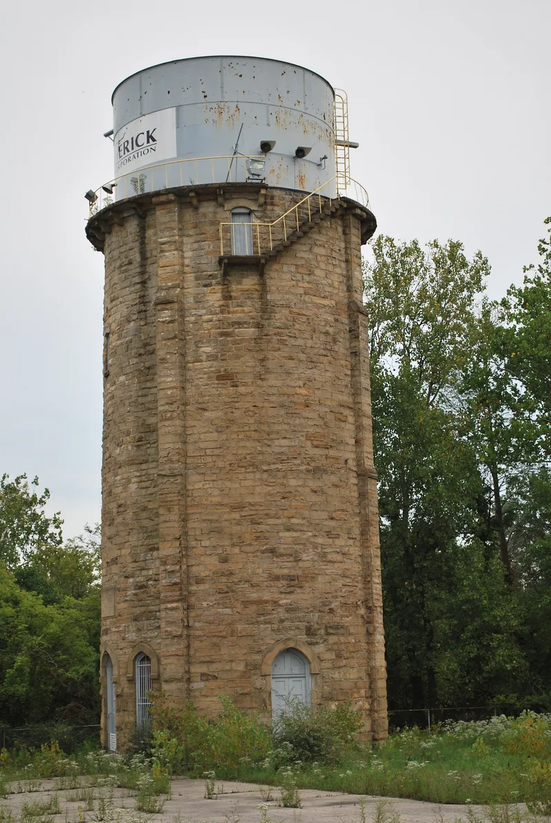
Built in 1879 beside the Black River in Elyria, Ohio, this round sandstone tower once held the water tank that supplied the city. Its rock-faced walls are four feet thick, and the door and window openings have Gothic arches. Four exterior buttresses reinforce the structure, and a balcony carried on large brackets circles the top. Inside is one open space with a stone spiral stair cantilevered from the walls. A brick pumping station originally stood at the base, with a house for the water department employee nearby. Elyria relied on the tower for many years, until the city decided in 1902 to pump water inland from Lake Erie. The tower and pumping station were then sold to the neighboring steel company, which still uses the tower to store water for cooling steel. As the city's first water system, it marks a milestone in local development, and its Victorian Gothic detailing adds architectural interest.
Significance in brief: It was the first water system of the city of Elyria and is described as a milestone in the community's development. It also has interesting Gothic detailing, including pointed arches and buttresses.
Machine-generated summary. This summary was generated by a language model from the official nomination document and has not been reviewed line by line by an editor. It may contain errors. Check the source document before relying on any detail. Source: nomination document (PDF) · National Archives catalog entry. NRHP reference 79002739, listed August 13, 1979. Summary generated October 2026 (model claude-sonnet-5-5, prompt v1.0-2026-10-29, confidence medium).
Key facts
| Address | S side of W. 15th St., 100 ft. W. of Black River Bridge, Elyria |
|---|---|
| County | Lorain County |
| Listed | August 13, 1979 |
| Reference number | 79002739 |
| Resource type | Structure |
| Period of significance | 1879 |
| Architectural style | Victorian Gothic |
| Areas of significance | Community Planning and Development |
| Level of significance | Local |
| Status (as stated in the nomination) | Still in use as a water tower; the form lists interior and exterior condition as good. |
| Acreage | 1.8 |
| Coordinates | 41.35249, -82.11493 (NPS GIS) |
What listing means for this property
National Register listing is honorary: it recognises significance and does not restrict what a private owner may do without federal money or permits. It unlocks the 20% federal rehabilitation tax credit for income-producing buildings, state credits in many states, and Section 106 review when federal agencies are involved. See what listing means in practice.
General information, not legal or tax advice. Rules change; confirm with your State Historic Preservation Office or a qualified adviser.
Sources and further reading
- National Park Service, National Register of Historic Places database (snapshot May 2026), reference 79002739.
- Nomination form (PDF, National Archives) — catalog entry
- Wikidata Q138507851
- This listing as JSON
Last updated October 2026. Found an error? See the editorial policy for how to report it.