Superior Avenue Viaduct

Why it's listed
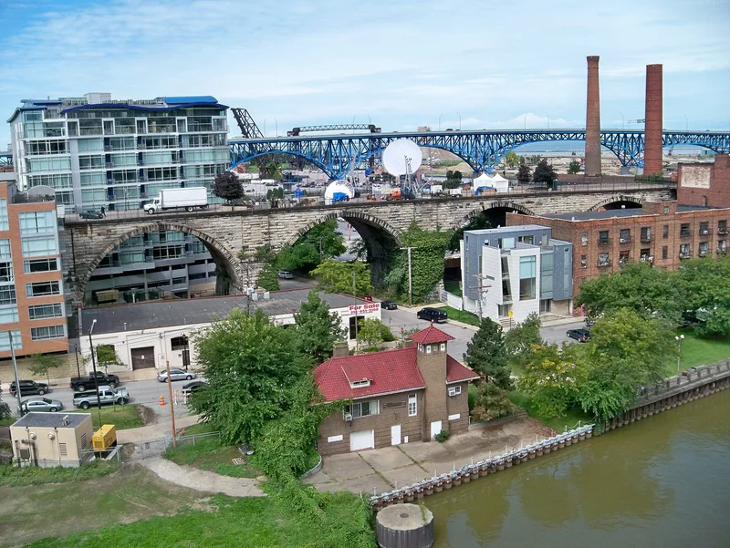
Rising above the west bank of the Cuyahoga Valley in Cleveland, this sandstone arch viaduct was built between 1875 and 1878 to carry pedestrians, vehicles and streetcars across the river valley and to remove dangerous railroad crossings at street level. The original structure ran 3,211 feet and included ten Berea sandstone arches, a 322-foot cantilever swing bridge over the river, and a plate-girder approach on the east. City engineers E. W. Ensign and B. F. Morse designed it. It was among the largest engineering projects in the country at the time and was the first major structure to join Cleveland's east and west sides. The Detroit-Superior Bridge replaced its function, and in 1922 most of it was demolished. About 580 feet survives, including eight stone arches, with the eastern half barricaded. Local supporters have proposed turning the remnant into an urban park.
Significance in brief: The nomination argues it was one of the largest engineering projects in America when built. It was also an important symbolic link between Cleveland's east and west sides. Its cantilever swing bridge was the first major one in Cleveland, and the viaduct was the first major transportation and commerce structure to join the two sides of the city.
Machine-generated summary. This summary was generated by a language model from the official nomination document and has not been reviewed line by line by an editor. It may contain errors. Check the source document before relying on any detail. Source: nomination document (PDF) · National Archives catalog entry. NRHP reference 78002043, listed June 9, 1978. Summary generated October 2026 (model claude-sonnet-5-5, prompt v1.0-2026-10-29, confidence medium).
Key facts
| Address | Superior Ave., Cleveland |
|---|---|
| County | Cuyahoga County |
| Listed | June 9, 1978 |
| Reference number | 78002043 |
| Resource type | Structure |
| Period of significance | 1875-1878; 1922 |
| Architect / builder | E. W. Ensign & B. F. Morse |
| Areas of significance | Commerce, Engineering, Transportation, Architecture |
| Level of significance | State |
| Status (as stated in the nomination) | Most of the viaduct was demolished in 1922. About 580 feet remains, including eight stone arches. The eastern half is low-barricaded and the western part is resurfaced for vehicle access to small commercial sites. Present use is listed as vacant. |
| Acreage | 0.9 |
| Coordinates | 41.49464, -81.70428 (NPS GIS) |
What listing means for this property
National Register listing is honorary: it recognises significance and does not restrict what a private owner may do without federal money or permits. It unlocks the 20% federal rehabilitation tax credit for income-producing buildings, state credits in many states, and Section 106 review when federal agencies are involved. See what listing means in practice.
Noted as vacant in the nomination. Nomination documents can be decades old; current status may differ. If you are considering buying an empty listed property, read the due-diligence checklist.
General information, not legal or tax advice. Rules change; confirm with your State Historic Preservation Office or a qualified adviser.
Sources and further reading
- National Park Service, National Register of Historic Places database (snapshot May 2026), reference 78002043.
- Nomination form (PDF, National Archives) — catalog entry
- Wikidata Q122227107
- This listing as JSON
Last updated October 2026. Found an error? See the editorial policy for how to report it.