Shaker Village Historic District (Boundary Increase)
Also known as: City of Shaker Heights

Why it's listed
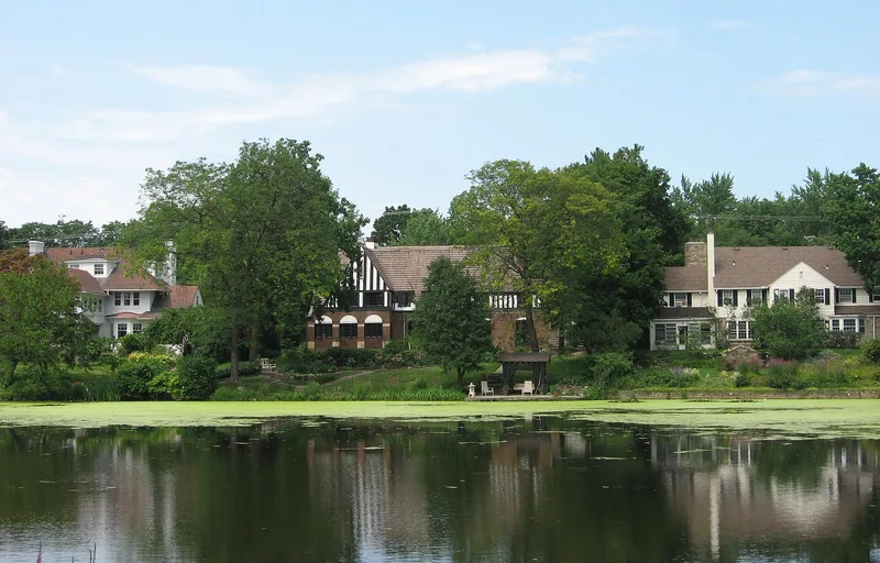
This 417-acre residential area in the southern part of Shaker Heights, Ohio, extends an existing historic district southward to the Cleveland border. It holds 2,607 buildings, of which 2,003 are counted as contributing. Most are single-family houses, with a smaller share of two-family homes and many garages. Development ran mainly from the 1920s to the 1960s on small, narrow, deep lots. Every house had to follow the Van Sweringen Company's Shaker Village Standards, which required Colonial, English or French Revival designs, authentic materials such as slate, brick, stone, stucco and wood shingles, and a standard two-story height. Uniform setbacks and mature street trees gave the neighborhood a wooded, cohesive look despite its dense lots. Tudor Revival, French Chateau, Colonial Revival, Dutch Colonial and Georgian Revival houses are all represented. The area was listed for its role in community planning and for its architecture, as a well-preserved example of an early twentieth-century planned garden suburb.
Significance in brief: The nomination argues the area is significant under Criterion A and Criterion C as part of an early 20th century planned garden-suburb community, loosely based on the Garden City philosophy. Houses were built to the Van Sweringen Company's architectural standards, which required Colonial, English or French revival styles, authentic materials, uniform setbacks and standard heights. The result is a cohesive streetscape that matches the existing district.
Machine-generated summary. This summary was generated by a language model from the official nomination document and has not been reviewed line by line by an editor. It may contain errors. Check the source document before relying on any detail. Source: nomination document (PDF) · National Archives catalog entry. NRHP reference 00001557, listed January 5, 2001. Summary generated October 2026 (model claude-sonnet-5-5, prompt v1.0-2026-10-29, confidence medium).
Key facts
| Address | Roughly bounded by Lomond Blvd., Lytel Rd., Scottsdale Blvd., and Lindholm Rd., Shaker Heights |
|---|---|
| County | Cuyahoga County |
| Listed | January 5, 2001 |
| Reference number | 00001557 |
| Resource type | District |
| Period of significance | 1919-1950 |
| Architect / builder | George Burrows; Maxwell Norcross; Dunn & Coppe; Chester Lowe; Fox, Duthie, Foose; John Sherwood Kelly |
| Architectural style | 20th century revivals: Colonial Revival, Tudor Revival, French Renaissance |
| Criteria |
|
| Areas of significance | Architecture, Community Planning and Development |
| Level of significance | Local |
| Status (as stated in the nomination) | The area is entirely residential and has changed little. Front elevations are rarely altered, though some roofing, windows and siding have been replaced. Many original bluestone sidewalks survive. |
| Acreage | 417 |
| Coordinates | 41.45884, -81.55062 (NPS GIS) |
What listing means for this property
This is a historic district. Buildings within its boundary are either contributing (they add to the district's significance) or non-contributing. Owners of contributing income-producing buildings can claim the 20% federal rehabilitation tax credit; homeowners should look at state credits. National Register districts impose no design review by themselves; a local historic district ordinance, if one exists, does (the difference explained).
General information, not legal or tax advice. Rules change; confirm with your State Historic Preservation Office or a qualified adviser.
Sources and further reading
- National Park Service, National Register of Historic Places database (snapshot May 2026), reference 00001557.
- Nomination form (PDF, National Archives) — catalog entry
- Wikipedia article (used for cross-checking only; text not reproduced here)
- Wikidata Q7462744
- This listing as JSON
Last updated October 2026. Found an error? See the editorial policy for how to report it.