Hessler Court Wooden Pavement

Why it's listed
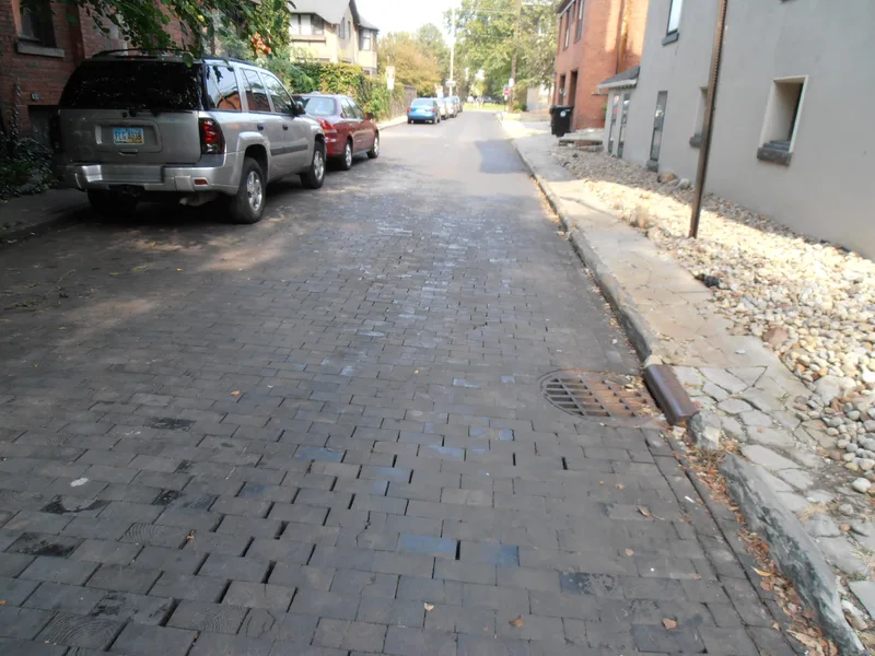
Hessler Court is a short one-way street in Cleveland paved with wooden blocks. The pavement runs about 275 feet and 19.5 feet wide between Bellflower Road and Hessler Road. Roughly 19,000 rectangular blocks, each 4.5 by 9 inches, are laid like brick courses with the end grain facing up. Small patches of concrete and asphalt have been added, but about 95 percent of the original paving remains. The street dates to 1906, though the nomination suggests it may have been an older private drive acquired by the city that year. Wood block paving was common in Cleveland in 1870 and was gradually replaced by Medina sandstone in the 1880s. The street was listed because it appears to be the only surviving segment of wood block pavement in the city. It serves as a one-way outlet for Hessler Road, a short early twentieth century residential street paved with brick.
Significance in brief: The nomination argues it is an extremely rare surviving section of wooden block pavement in Cleveland, and as far as is known the only one left in the city. Wood block paving was once common in Cleveland but was largely replaced with stone and brick from the 1880s. It is recognized under engineering and transportation.
Machine-generated summary. This summary was generated by a language model from the official nomination document and has not been reviewed line by line by an editor. It may contain errors. Check the source document before relying on any detail. Source: nomination document (PDF) · National Archives catalog entry. NRHP reference 75001362, listed March 3, 1975. Summary generated October 2026 (model claude-sonnet-5-5, prompt v1.0-2026-10-29, confidence medium).
Key facts
| Address | 11330 East Blvd. between Bellflower and Hessler Rds., Cleveland |
|---|---|
| County | Cuyahoga County |
| Listed | March 3, 1975 |
| Reference number | 75001362 |
| Resource type | Structure |
| Period of significance | 1906 (20th century) |
| Areas of significance | Engineering |
| Level of significance | State |
| Status (as stated in the nomination) | Condition is listed as good and altered; about 95 percent of the original paving is intact, with small patches repaired in concrete and asphalt. The form marks it as occupied and in transportation use. |
| Acreage | 0.9 |
| Coordinates | 41.51096, -81.60547 (NPS GIS) |
What listing means for this property
National Register listing is honorary: it recognises significance and does not restrict what a private owner may do without federal money or permits. It unlocks the 20% federal rehabilitation tax credit for income-producing buildings, state credits in many states, and Section 106 review when federal agencies are involved. See what listing means in practice.
General information, not legal or tax advice. Rules change; confirm with your State Historic Preservation Office or a qualified adviser.
Sources and further reading
- National Park Service, National Register of Historic Places database (snapshot May 2026), reference 75001362.
- Nomination form (PDF, National Archives) — catalog entry
- Wikidata Q137698153
- This listing as JSON
Last updated October 2026. Found an error? See the editorial policy for how to report it.