Beginning Point of the U.S. Public Land Survey
Also known as: Beginning Point

Why it's listed
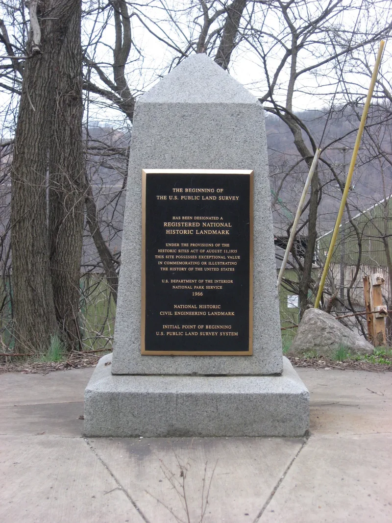
Near the Ohio-Pennsylvania line, 2 miles east of East Liverpool, a small granite marker commemorates the starting point of the first U.S. public land survey. The exact original location is unknown and lies under water behind a dam, so the marker stands in for it. Its inscription says the point of beginning was 1,112 feet south. The survey followed the Land Ordinance of May 20, 1785, which called for townships six miles square divided into 36 sections. Geographer Thomas Hutchins began the work on September 30, 1785, using a stake set by Virginia-Pennsylvania boundary commissioners. Work stopped in October because of threatened Indian hostility and resumed in 1786. By 1788 the first seven ranges had been surveyed. The rectangular system was later applied to the public domain that formed 31 states, and its imprint remains visible in field patterns and section-line roads. The East Liverpool Historical Society owns and maintains the site.
Significance in brief: The nomination argues this is where the rectangular land survey system used for public lands was inaugurated. The system was used to survey the public domain that became 31 states, and it shaped the American landscape through its angular fields and section-line roads. It is also described as the first mathematically designed national cadastral survey system in any modern country.
Machine-generated summary. This summary was generated by a language model from the official nomination document and has not been reviewed line by line by an editor. It may contain errors. Check the source document before relying on any detail. Source: nomination document (PDF) · National Archives catalog entry. NRHP reference 66000606, listed October 15, 1966. Summary generated October 2026 (model claude-sonnet-5-5, prompt v1.0-2026-10-29, confidence medium).
Key facts
| Address | On the OH/PA Border, E of East Liverpool, East Liverpool |
|---|---|
| County | Columbiana County |
| Listed | October 15, 1966 |
| Reference number | 66000606 |
| Resource type | Site |
| Period of significance | 18th Century; specific date August 9, 1786 |
| Areas of significance | Engineering, Communications |
| Level of significance | National |
| National Historic Landmark | Yes, designated June 23, 1965 |
| Status (as stated in the nomination) | Maintained in very good condition by the East Liverpool Historical Society; the marker was moved about fifty feet in 1960 and the original survey location is covered by water from a dam. |
| Acreage | 0.9 |
| Coordinates | 40.64246, -80.51917 (NPS GIS) |
What listing means for this property
Sites (archaeological sites, battlefields, landscapes) are often listed with a restricted address to protect them from looting or disturbance. Listing is honorary for private owners; federal undertakings on or near the site go through Section 106 review, and state laws may protect burials and artefacts regardless of listing.
General information, not legal or tax advice. Rules change; confirm with your State Historic Preservation Office or a qualified adviser.
Sources and further reading
- National Park Service, National Register of Historic Places database (snapshot May 2026), reference 66000606.
- Nomination form (PDF, National Archives) — catalog entry
- Wikipedia article (used for cross-checking only; text not reproduced here)
- Wikidata Q4880494
- This listing as JSON
Last updated October 2026. Found an error? See the editorial policy for how to report it.