Fort Dobbs

Why it's listed
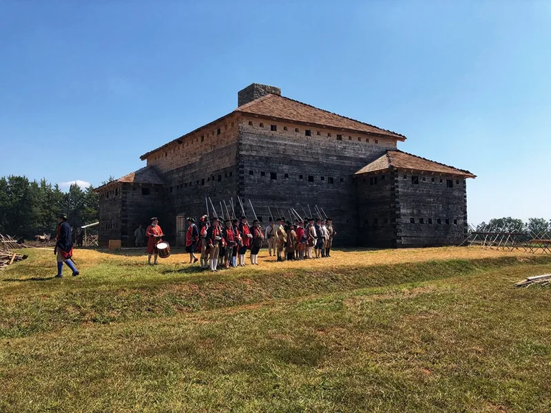
Fort Dobbs, near Statesville in Iredell County, was built by North Carolina provincial forces in 1756 on a ridge in a fork of Fourth Creek. Its centerpiece was a three-story oak log blockhouse-barrack measuring forty by fifty-three feet, loopholed for defense and ringed by a star-shaped palisade, ditch and parapet. It was the colony's only frontier post during the French and Indian War. Its small ranger garrison, led by Hugh Waddell, patrolled the Piedmont, joined the Forbes expedition and took part in campaigns against the Cherokees. In February 1760 a large Cherokee band tried to storm the fort and was repulsed. The garrison was withdrawn in 1763, and the land was later farmed, with erosion wearing away much of the site. Test excavations in 1967 and 1968 and a major dig in 1969 confirmed the fort's location, size, well, cellar and defensive ditch. The design, resembling a compact keep, is considered unusual among frontier forts.
Significance in brief: It was North Carolina's only frontier post during the French and Indian War, and its small garrison defended the frontier and joined southern intercolonial expeditions. Its design, a massive three-story loopholed log barrack with flankers and a palisade, was an unusual frontier improvisation outside the mainstream of military engineering. Archaeology in 1967-1969 confirmed the fort's size and features.
Machine-generated summary. This summary was generated by a language model from the official nomination document and has not been reviewed line by line by an editor. It may contain errors. Check the source document before relying on any detail. Source: nomination document (PDF) · National Archives catalog entry. NRHP reference 70000458, listed September 15, 1970. Summary generated October 2026 (model claude-sonnet-5-5, prompt v1.0-2026-10-29, confidence high).
Key facts
| Address | Fort Dobbs Rd., Statesville |
|---|---|
| County | Iredell County |
| Listed | September 15, 1970 |
| Reference number | 70000458 |
| Resource type | Site |
| Period of significance | 1756-1763 |
| Architect / builder | North Carolina Provincial forces |
| Areas of significance | Military, Politics/Government |
| Level of significance | State |
| Status (as stated in the nomination) | Archaeological remains; about 85 percent was excavated in 1969 and the exposed features were stabilized and drained. The site is altered by erosion, farming and road realignment. |
| Acreage | 9.5 |
| Coordinates | 35.82144, -80.88268 (NPS GIS) |
What listing means for this property
Sites (archaeological sites, battlefields, landscapes) are often listed with a restricted address to protect them from looting or disturbance. Listing is honorary for private owners; federal undertakings on or near the site go through Section 106 review, and state laws may protect burials and artefacts regardless of listing.
General information, not legal or tax advice. Rules change; confirm with your State Historic Preservation Office or a qualified adviser.
Sources and further reading
- National Park Service, National Register of Historic Places database (snapshot May 2026), reference 70000458.
- Nomination form (PDF, National Archives) — catalog entry
- Wikipedia article (used for cross-checking only; text not reproduced here)
- Wikidata Q4868703
- This listing as JSON
Last updated October 2026. Found an error? See the editorial policy for how to report it.