Horton Grove Complex

Why it's listed
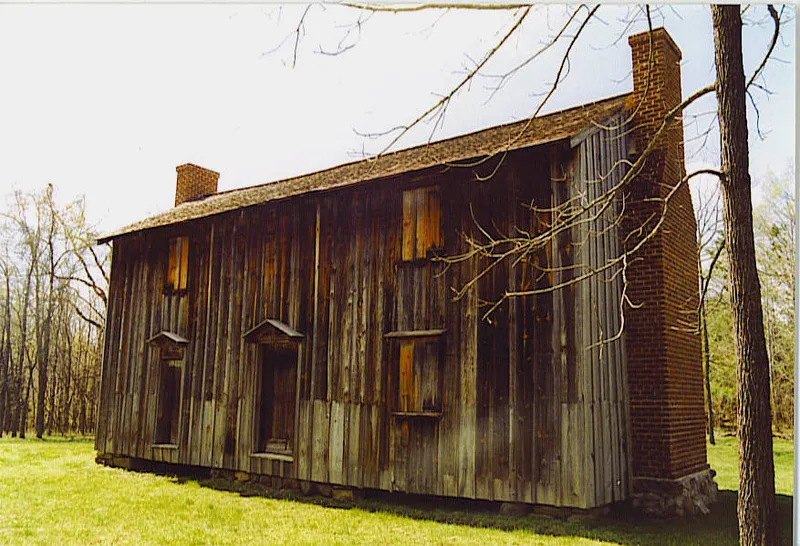
Horton Grove is a cluster of agricultural buildings on a ridge above the Flat River in Durham County, once one of several plantation centers in the Bennehan and Cameron family estate. It includes a small plank-built dwelling from the late eighteenth or early nineteenth century, probably the home of the Horton family, along with tobacco barns and four nearly identical two-story slave houses. These are of heavy timber frame with brick nogging, with a central stair hall and a large room on each floor. A 135-foot stable, built in 1860 and believed to be Paul Cameron's work, has a complex queen post roof truss. The slave houses are valued as rare survivors and for the family history associated with them; black families continued to live at Horton Grove after the Civil War. The Liggett Group donated the land to the state for preservation and study, and a later form describes it as an open state historic site.
Significance in brief: The nomination argues that the slave houses are rare survivors of a slave housing complex and are important to black history, including the continuity of black families there after Emancipation. The great barn is cited as an outstanding example of antebellum craftsmanship and scale, and the site is linked to Paul Cameron. Archeological surveys are also said to indicate a wealth of potential information.
Machine-generated summary. This summary was generated by a language model from the official nomination document and has not been reviewed line by line by an editor. It may contain errors. Check the source document before relying on any detail. Source: nomination document (PDF) · National Archives catalog entry. NRHP reference 78001946, listed March 17, 1978. Summary generated October 2026 (model claude-sonnet-5-5, prompt v1.0-2026-10-29, confidence high).
Key facts
| Address | N of Durham on SR 1626, Durham |
|---|---|
| County | Durham County |
| Listed | March 17, 1978 |
| Reference number | 78001946 |
| Resource type | Building |
| Period of significance | 1700-1899 |
| Criteria |
|
| Areas of significance | Agriculture, Historic - Non-Aboriginal, Black, Architecture |
| Level of significance | State |
| Status (as stated in the nomination) | A 2007 additional-documentation sheet states the property is in use and open to the public as a state historic site (museum). The 1978 form described the early house as dilapidated. |
| Acreage | 3.5 |
| Coordinates | 36.12831, -78.83840 (NPS GIS) |
What listing means for this property
National Register listing is honorary: it recognises significance and does not restrict what a private owner may do without federal money or permits. It unlocks the 20% federal rehabilitation tax credit for income-producing buildings, state credits in many states, and Section 106 review when federal agencies are involved. See what listing means in practice.
General information, not legal or tax advice. Rules change; confirm with your State Historic Preservation Office or a qualified adviser.
Sources and further reading
- National Park Service, National Register of Historic Places database (snapshot May 2026), reference 78001946.
- Nomination form (PDF, National Archives) — catalog entry
- Wikipedia article (used for cross-checking only; text not reproduced here)
- Wikidata Q5906838
- This listing as JSON
Last updated October 2026. Found an error? See the editorial policy for how to report it.