Fair Grove Methodist Church Cemetery

Why it's listed
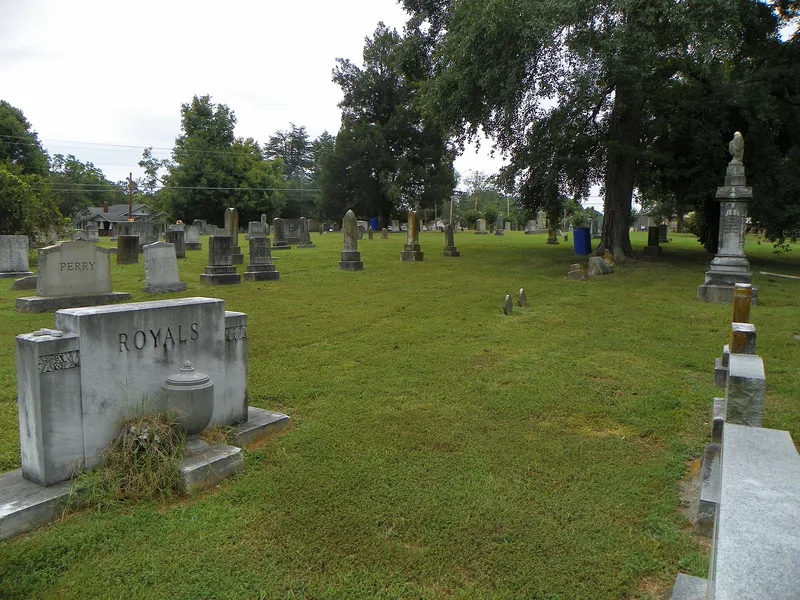
Fair Grove Methodist Church Cemetery is a roughly 2.5-acre burial ground in north Davidson County, North Carolina, holding about 400 gravestones. The church congregation, the first known Methodist group in the county, was established by 1828 when land was deeded for a church building. About 15 of the earliest locally made stones sit beneath old cedar trees in front of the church. The oldest, dated 1829, is credited to stonecutter Thomas Fisher and is the only known stone by him. Six slate-like stones from the 1840s have simple classical designs and professional lettering. The headstones of Margaret and George Hoover, also dated 1829, are considered the peak of the Swisegood School. The cemetery was listed because these decorated soapstone markers, with folk symbols of resurrection and eternity, show the height of folk art among the area's Anglo-German farmers, and because it includes two of the county's finest Pierced Style examples.
Significance in brief: The cemetery holds a unique collection of folk gravestones made by local stonecutters in the late 18th and first half of the 19th century. Decorated soapstone markers with folk symbols of resurrection and eternity represent the height of folk art among the Anglo-German farmers of north Davidson County. It also contains two of the finest examples of the "Pierced Style" in the county.
Machine-generated summary. This summary was generated by a language model from the official nomination document and has not been reviewed line by line by an editor. It may contain errors. Check the source document before relying on any detail. Source: nomination document (PDF) · National Archives catalog entry. NRHP reference 84002004, listed July 10, 1984. Summary generated October 2026 (model claude-sonnet-5-5, prompt v1.0-2026-10-29, confidence medium).
Key facts
| Address | NC 109, SR 2072 and 2070, South Thomasville |
|---|---|
| County | Davidson County |
| Listed | July 10, 1984 |
| Reference number | 84002004 |
| Resource type | Site |
| Period of significance | 1800-1899 |
| Architect / builder | Stonecutters unknown; one 1829 gravestone is attributed to stonecutter Thomas Fisher |
| Criteria |
|
| Areas of significance | Art, Architecture |
| Level of significance | National |
| Status (as stated in the nomination) | Condition marked fair, deteriorated and unaltered on the form; original site. |
| Acreage | 2.5 |
| Coordinates | 35.85146, -80.07806 (NPS GIS) |
What listing means for this property
Sites (archaeological sites, battlefields, landscapes) are often listed with a restricted address to protect them from looting or disturbance. Listing is honorary for private owners; federal undertakings on or near the site go through Section 106 review, and state laws may protect burials and artefacts regardless of listing.
General information, not legal or tax advice. Rules change; confirm with your State Historic Preservation Office or a qualified adviser.
Sources and further reading
- National Park Service, National Register of Historic Places database (snapshot May 2026), reference 84002004.
- Nomination form (PDF, National Archives) — catalog entry
- Wikipedia article (used for cross-checking only; text not reproduced here)
- Wikidata Q5429814
- This listing as JSON
Last updated October 2026. Found an error? See the editorial policy for how to report it.