Brunswick Town Historic District
Also known as: Old Brunswick; Fort Anderson,Brunswick Town State Historic Si

Why it's listed
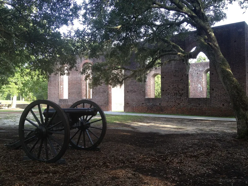
Brunswick Town Historic District covers about 120 acres along the Cape Fear River in Brunswick County, North Carolina. It contains the ruins of a colonial port town and the earthworks of Civil War Fort Anderson. Founded in the early 1700s, Brunswick was home to merchants, sea captains and officials, and in 1765 a group of citizens surrounded Governor Tryon's house at Russellborough to protest the Stamp Act, an early use of arms against British authority. The town declined as Wilmington grew and was burned during the British raid of 1776. In 1862 Confederate forces built Fort Anderson on the site, incorporating the walls of St. Philips Church, and abandoned it in February 1865. Archeologist Stanley South excavated about 25 of 65 foundations between 1958 and 1968, including houses, a public house, wells and a smokehouse. Visitors walk trails past the ruins, the pond, the batteries and the church.
Significance in brief: The district preserves the foundations of a colonial port town that was an influential center in North Carolina and the site of early armed resistance to the Stamp Act in 1765. The town was burned in 1776 and later became the site of Confederate Fort Anderson. Archeological excavation from 1958 to 1968 recovered a detailed picture of colonial life and Civil War occupation.
Machine-generated summary. This summary was generated by a language model from the official nomination document and has not been reviewed line by line by an editor. It may contain errors. Check the source document before relying on any detail. Source: nomination document (PDF) · National Archives catalog entry. NRHP reference 78001932, listed September 6, 1978. Summary generated October 2026 (model claude-sonnet-5-5, prompt v1.0-2026-10-29, confidence medium).
Key facts
| Address | N of Southport off SR 133, Southport |
|---|---|
| County | Brunswick County |
| Listed | September 6, 1978 |
| Reference number | 78001932 |
| Resource type | District |
| Areas of significance | Historic - Non-Aboriginal, Military, Exploration/Settlement, Science, Politics/Government |
| Level of significance | National |
| Status (as stated in the nomination) | Owned by the state and open to the public as a museum and park; the site is in ruins, with excavated foundations protected by fences and St. Philips Church walls still standing. |
| Acreage | 225 |
| Within district | Orton Plantation (Boundary Increase) |
| Coordinates | 34.04064, -77.94437 (NPS GIS) |
What listing means for this property
This is a historic district. Buildings within its boundary are either contributing (they add to the district's significance) or non-contributing. Owners of contributing income-producing buildings can claim the 20% federal rehabilitation tax credit; homeowners should look at state credits. National Register districts impose no design review by themselves; a local historic district ordinance, if one exists, does (the difference explained).
General information, not legal or tax advice. Rules change; confirm with your State Historic Preservation Office or a qualified adviser.
Sources and further reading
- National Park Service, National Register of Historic Places database (snapshot May 2026), reference 78001932.
- Nomination form (PDF, National Archives) — catalog entry
- Wikipedia article (used for cross-checking only; text not reproduced here)
- Wikidata Q4979555
- This listing as JSON
Last updated October 2026. Found an error? See the editorial policy for how to report it.