Fort Golgotha and the Old Burial Hill Cemetery

Why it's listed
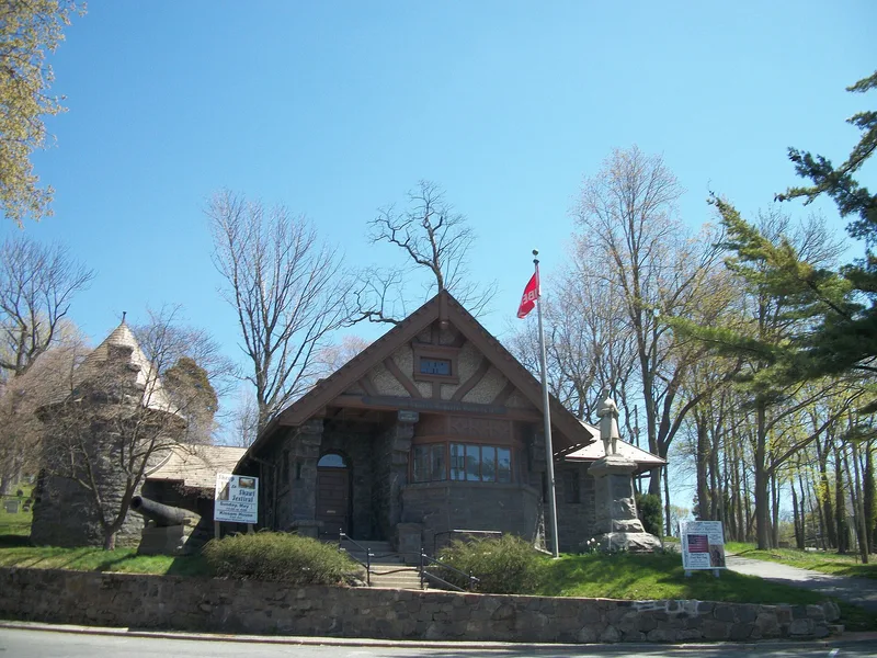
Fort Golgotha and the Old Burial Hill Cemetery occupy a small hill in Huntington, Long Island, overlooking the harbor and Long Island Sound. The cemetery was in use by about 1700, and the remains of a British earthwork fort built in November 1782 lie within its limits. Colonel Benjamin Thompson, later known as Count Rumford, oversaw construction while peace negotiations were already under way. Local accounts say his men used tombstones as tables and ovens, and more than one hundred headstones are believed to have been destroyed. The fort's purpose remains debated, with defense, winter shelter and deliberate harassment of residents all suggested. Excavations in 1973 and 1980 recovered military artifacts and traces of floors, and further work could clarify the fort's function. The surviving headstones have also served research, showing that early stones came from Connecticut, Boston, Newport and elsewhere, which reveals colonial trade patterns. The town owns the site and uses it as a museum.
Significance in brief: The nomination argues the site is significant for its historical associations and research potential. The fort was built late in the war, apparently to harass local patriots, and its builders used cemetery headstones as tables and ovens. Archaeology could clarify the fort's purpose, and the cemetery's headstones have revealed colonial trade networks.
Machine-generated summary. This summary was generated by a language model from the official nomination document and has not been reviewed line by line by an editor. It may contain errors. Check the source document before relying on any detail. Source: nomination document (PDF) · National Archives catalog entry. NRHP reference 81000415, listed March 2, 1981. Summary generated October 2026 (model claude-sonnet-5-5, prompt v1.0-2026-10-29, confidence medium).
Key facts
| Address | Main St. and Nassau Rd., Huntington |
|---|---|
| County | Suffolk County |
| Listed | March 2, 1981 |
| Reference number | 81000415 |
| Resource type | Site |
| Period of significance | 1782 |
| Architect / builder | Colonel Benjamin Thompson |
| Criteria |
|
| Areas of significance | Historic - Non-Aboriginal, Art |
| Level of significance | Local |
| Status (as stated in the nomination) | Owned and maintained by the Town of Huntington and used as a museum; the last burial was in 1948. Visible fort remains are meager, and two archaeological investigations have been carried out. |
| Acreage | 2.5 |
| Coordinates | 40.87163, -73.42341 (NPS GIS) |
What listing means for this property
Sites (archaeological sites, battlefields, landscapes) are often listed with a restricted address to protect them from looting or disturbance. Listing is honorary for private owners; federal undertakings on or near the site go through Section 106 review, and state laws may protect burials and artefacts regardless of listing.
General information, not legal or tax advice. Rules change; confirm with your State Historic Preservation Office or a qualified adviser.
Sources and further reading
- National Park Service, National Register of Historic Places database (snapshot May 2026), reference 81000415.
- Nomination form (PDF, National Archives) — catalog entry
- Wikipedia article (used for cross-checking only; text not reproduced here)
- Wikidata Q5471233
- This listing as JSON
Last updated October 2026. Found an error? See the editorial policy for how to report it.