Champlain Canal
Also known as: See Also:Northside Historic District

Why it's listed
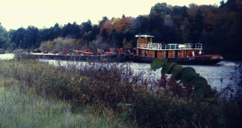
The old Champlain Canal is a stretch of abandoned waterway of roughly 76 to 80 miles in Saratoga and Washington Counties, New York, running from Troy and Waterford north to Whitehall. Opened in 1823, it joined Lake Champlain with the Hudson, the Mohawk River and the Erie Canal. It used locks, aqueducts and culverts, and followed stretches of Wood Creek and the Hudson. The canal turned small hamlets into trade and industry centers, with mills and warehouses appearing along its banks. It carried timber, iron, marble and farm goods from New York, Vermont and Canada, and provided work for immigrants, especially Irish laborers. Building it also served as an early school of engineering. By 1856 it was the most productive canal in the state system. Rerouting under the Barge Canal in 1903 left the old route abandoned. Parts survive, including locks at Waterford and masonry in good condition, while other sections have been lost to dumping or later construction.
Significance in brief: The canal's completion in 1823 spurred development north of Albany, turning small hamlets into centers of trade and industry. It carried agricultural, forest and manufactured goods from New York and Vermont, plus trade with Canada. Its construction also served as an early American school of engineering and gave work to immigrants, especially Irish laborers.
Machine-generated summary. This summary was generated by a language model from the official nomination document and has not been reviewed line by line by an editor. It may contain errors. Check the source document before relying on any detail. Source: nomination document (PDF) · National Archives catalog entry. NRHP reference 76001274, listed September 1, 1976. Summary generated October 2026 (model claude-sonnet-5-5, prompt v1.0-2026-10-29, confidence medium).
Key facts
| Address | Extends N from Troy to Whitehall, Troy |
|---|---|
| County | Saratoga County |
| Listed | September 1, 1976 |
| Reference number | 76001274 |
| Resource type | District |
| Period of significance | 19th Century (specific date 1823) |
| Architect / builder | Erie Canal engineering staff: Benjamin Wright (principal engineer), James Geddes, Canvas White, Nathan Roberts, all under John B. Jervis |
| Areas of significance | Industry, Commerce, Engineering, Transportation |
| Level of significance | State |
| Status (as stated in the nomination) | Condition rated fair to ruins. The route is largely intact from Waterford to south of Mechanicville, though parts are lost or obliterated. One portion is used as a dump and the rest is abandoned land. Lock masonry is in good preservation. |
| Acreage | 1290 |
| Coordinates | 43.18740, -73.54733 (NPS GIS) |
What listing means for this property
This is a historic district. Buildings within its boundary are either contributing (they add to the district's significance) or non-contributing. Owners of contributing income-producing buildings can claim the 20% federal rehabilitation tax credit; homeowners should look at state credits. National Register districts impose no design review by themselves; a local historic district ordinance, if one exists, does (the difference explained).
Noted as vacant in the nomination. Nomination documents can be decades old; current status may differ. If you are considering buying an empty listed property, read the due-diligence checklist.
General information, not legal or tax advice. Rules change; confirm with your State Historic Preservation Office or a qualified adviser.
Sources and further reading
- National Park Service, National Register of Historic Places database (snapshot May 2026), reference 76001274.
- Nomination form (PDF, National Archives) — catalog entry
- Wikipedia article (used for cross-checking only; text not reproduced here)
- Wikidata Q2935911
- This listing as JSON
Last updated October 2026. Found an error? See the editorial policy for how to report it.