Rockland Road Bridge
Also known as: Dot Bin # 3224170

Why it's listed
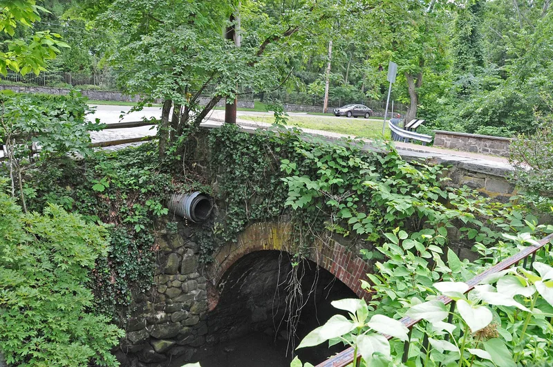
Rockland Road Bridge carries a short stretch of road over Sparkill Creek in the Village of Piermont, joining Piermont and Ferdon avenues. Built in 1874, it is a single-span arch about 22 feet long and 30 feet wide, made of red brick for the arch and roughly dressed local stone for the spandrel and wing walls. The mix of brick and stone gives it a distinctive two-tone look. The bridge sits at what was historically the head of navigation on the creek, a tributary of the Hudson River that helped spur the growth of Piermont, and it stands beside Haddock Hall, completed two years later. Its significance rests on its value as a surviving example of traditional masonry arch construction, a method that fell out of favor as standardized metal truss bridges spread. The builders are unknown. Some repointing and wing wall repair were needed when the property was documented, though the structure remained largely intact.
Significance in brief: The bridge is locally significant as an intact example of nineteenth century masonry arch bridge construction, a traditional method that was losing ground to standardized metal truss bridges. It sits at the historic head of navigation on Sparkill Creek, beside Haddock Hall, and is described as a noteworthy masonry arch bridge in Rockland County.
Machine-generated summary. This summary was generated by a language model from the official nomination document and has not been reviewed line by line by an editor. It may contain errors. Check the source document before relying on any detail. Source: nomination document (PDF) · National Archives catalog entry. NRHP reference 05001391, listed December 7, 2005. Summary generated October 2026 (model claude-sonnet-5-5, prompt v1.0-2026-10-29, confidence high).
Key facts
| Address | Rockland Rd., (bounded by Piermont and Ferdon Aves.), Village of Piermont |
|---|---|
| County | Rockland County |
| Listed | December 7, 2005 |
| Reference number | 05001391 |
| Resource type | Structure |
| Period of significance | 1874 |
| Criteria |
|
| Areas of significance | Engineering |
| Level of significance | Local |
| Status (as stated in the nomination) | Largely intact, but repointing is needed and the southwest wing wall has partially collapsed; the county highway department was working on repairs. The road remains in use carrying two lanes of traffic. |
| Acreage | 0.9 |
| Coordinates | 41.03504, -73.91914 (NPS GIS) |
What listing means for this property
For a publicly owned building or structure, listing mainly matters when federal funds, permits or licences are involved: projects then go through Section 106 review so effects on the property are considered. Listing also strengthens applications for preservation grants and, for leased income-producing uses, can enable the federal rehabilitation tax credit.
General information, not legal or tax advice. Rules change; confirm with your State Historic Preservation Office or a qualified adviser.
Sources and further reading
- National Park Service, National Register of Historic Places database (snapshot May 2026), reference 05001391.
- Nomination form (PDF, National Archives) — catalog entry
- Wikipedia article (used for cross-checking only; text not reproduced here)
- Wikidata Q7355460
- This listing as JSON
Last updated October 2026. Found an error? See the editorial policy for how to report it.