Bennington Battlefield
Also known as: Bennington Battlefield State Park

Why it's listed
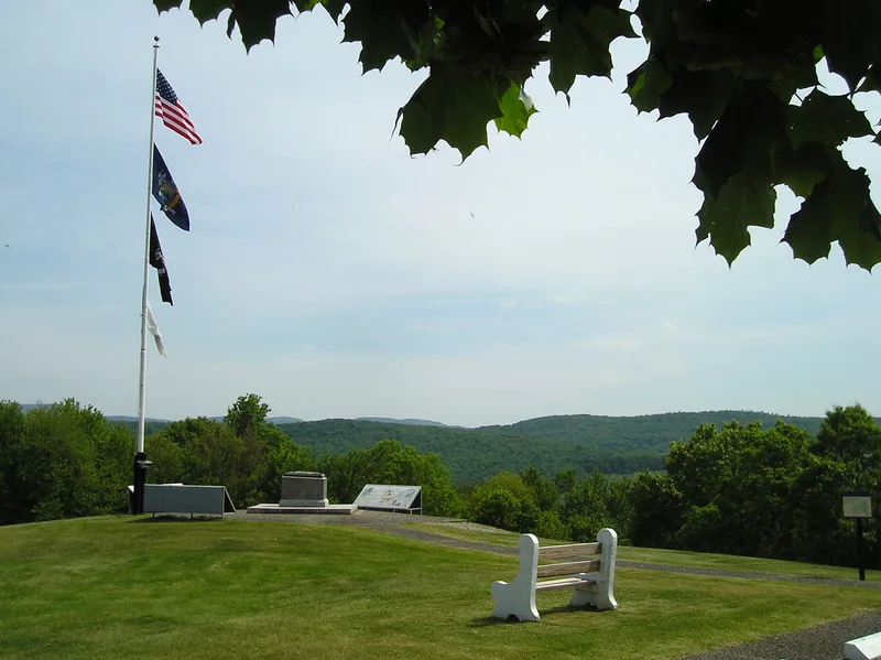
Bennington Battlefield is the site of a Revolutionary War engagement fought on August 16, 1777, along the Walloomsac River in Rensselaer County, New York. A British and German force of about 800 men, sent by General Burgoyne to seize supplies stored at Bennington, Vermont, was met by militia under General John Stark. The Americans surrounded the dispersed British positions, including a fortified hilltop and a bridge, and routed them. A second fight followed to the west against reinforcements led by Breymann. The victory cost the British roughly ten percent of their army and deprived them of supplies before the Saratoga campaign. Today the landscape remains mostly farm and woodland. A state park on the main British hilltop holds monuments and a bronze relief map of the battle. Modern houses, a railroad bed and a rerouted road are intrusions, and the second battleground is less well preserved than the first.
Significance in brief: The American militia victory at the Battle of Bennington contributed to the defeat of Burgoyne's British army at Saratoga two months later. The battle cost the British about ten percent of their strength and denied them supplies needed for their advance down the Hudson. It also discouraged Burgoyne's Indian allies and encouraged militia enlistment.
Machine-generated summary. This summary was generated by a language model from the official nomination document and has not been reviewed line by line by an editor. It may contain errors. Check the source document before relying on any detail. Source: nomination document (PDF) · National Archives catalog entry. NRHP reference 66000564, listed October 15, 1966. Summary generated October 2026 (model claude-sonnet-5-5, prompt v1.0-2026-10-29, confidence medium).
Key facts
| Address | NY 67, on VT state line, Walloomsac |
|---|---|
| County | Rensselaer County |
| Listed | October 15, 1966 |
| Reference number | 66000564 |
| Resource type | Site |
| Period of significance | August 16, 1777 |
| Areas of significance | Military |
| Level of significance | National |
| National Historic Landmark | Yes, designated January 20, 1961 |
| Status (as stated in the nomination) | Described as basically unchanged farmland and woodland, in good condition and well maintained, with state park facilities on the hilltop and some modern houses and a school along Route 67. The second engagement area is less well preserved, and San Coick Mill no longer exists. |
| Acreage | 1250 |
| Coordinates | 42.93453, -73.30407 (NPS GIS) |
What listing means for this property
Sites (archaeological sites, battlefields, landscapes) are often listed with a restricted address to protect them from looting or disturbance. Listing is honorary for private owners; federal undertakings on or near the site go through Section 106 review, and state laws may protect burials and artefacts regardless of listing.
General information, not legal or tax advice. Rules change; confirm with your State Historic Preservation Office or a qualified adviser.
Sources and further reading
- National Park Service, National Register of Historic Places database (snapshot May 2026), reference 66000564.
- Nomination form (PDF, National Archives) — catalog entry
- Wikipedia article (used for cross-checking only; text not reproduced here)
- Wikidata Q4889877
- This listing as JSON
Last updated October 2026. Found an error? See the editorial policy for how to report it.