Thornden Park

Why it's listed
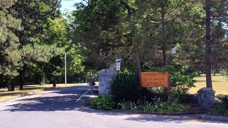
Thornden Park occupies 76 acres on a ridge overlooking the Onondaga Valley, downtown Syracuse and Onondaga Lake. Before the city bought it in 1921, the land was the Thornden estate of Major Alexander Davis, whose Tudor-style house stood amid manicured lawns, rare imported trees, greenhouses, farm fields and the first golf course in Syracuse. The park designed in the 1920s kept much of this earlier pleasure ground landscape, including its rolling topography, specimen trees and a surviving outbuilding. New features followed the ideals of the Reform Era park: a rose garden and pavilion from 1925, the Elon P. Stewart Standpipe, a bathhouse, a semicircular amphitheater from 1930, and a limestone field house from 1933 built with relief-program funding. Rustic stone stairs, walls and entry piers add to the character. The park is counted as locally significant for combining an estate landscape with early twentieth-century municipal park design.
Significance in brief: The nomination presents it as a Reform Era park of the early twentieth century, designed to fit within an earlier Romantic pleasure ground landscape. It keeps rustic stone buildings and structures from the 1920s and 1930s, gardens, and landforms from the estate period. Its estate grounds were among the most extensive residential landscapes in the Syracuse area.
Machine-generated summary. This summary was generated by a language model from the official nomination document and has not been reviewed line by line by an editor. It may contain errors. Check the source document before relying on any detail. Source: nomination document (PDF) · National Archives catalog entry. NRHP reference 94001490, listed December 29, 1994. Summary generated October 2026 (model claude-sonnet-5-5, prompt v1.0-2026-10-29, confidence medium).
Key facts
| Address | Roughly bounded by Ostrom Ave., Madison St., Beech St., Bristol Pl., Greenwood Pl. and Clarendon St., Syracuse |
|---|---|
| County | Onondaga County |
| Listed | December 29, 1994 |
| Reference number | 94001490 |
| Resource type | Site |
| Architectural style | Other: Pleasure Ground; Reform Era Park |
| Areas of significance | Community Planning and Development, Entertainment/Recreation, Landscape Architecture |
| Level of significance | Local |
| Status (as stated in the nomination) | Currently used as a public park with gardens and outdoor recreation. Condition ranges from excellent to poor, with some buildings altered and the estate outbuilding in fair to poor repair. |
| Acreage | 76 |
| Within district | Westcott-University Neighborhood Historic District |
| Coordinates | 43.04061, -76.12588 (NPS GIS) |
What listing means for this property
Sites (archaeological sites, battlefields, landscapes) are often listed with a restricted address to protect them from looting or disturbance. Listing is honorary for private owners; federal undertakings on or near the site go through Section 106 review, and state laws may protect burials and artefacts regardless of listing.
General information, not legal or tax advice. Rules change; confirm with your State Historic Preservation Office or a qualified adviser.
Sources and further reading
- National Park Service, National Register of Historic Places database (snapshot May 2026), reference 94001490.
- Nomination form (PDF, National Archives) — catalog entry
- Wikipedia article (used for cross-checking only; text not reproduced here)
- Wikidata Q7796361
- This listing as JSON
Last updated October 2026. Found an error? See the editorial policy for how to report it.