Christ Church and Manlius Village Cemeteries
Also known as: Manlius Church Yard

Why it's listed
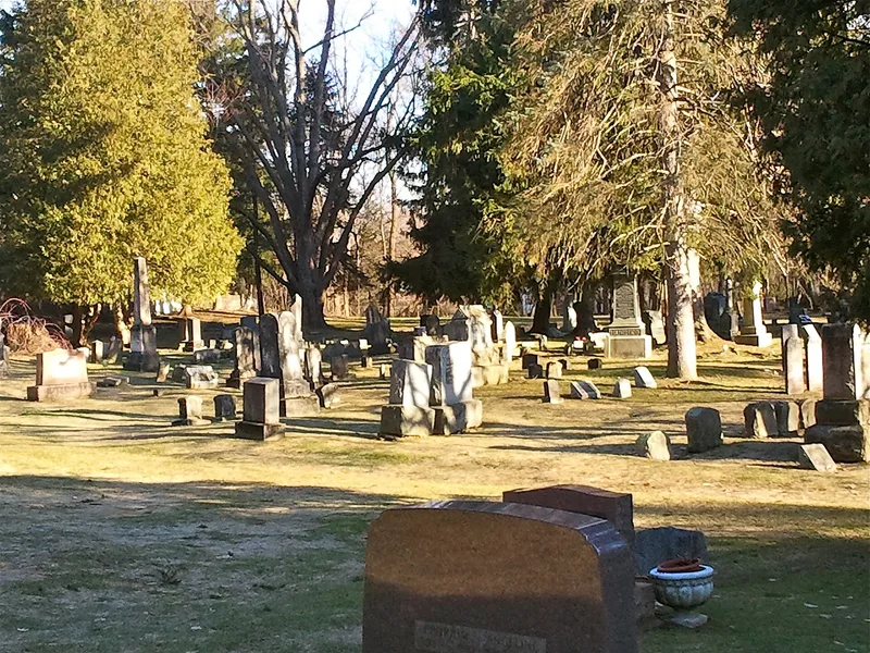
Christ Church Cemetery and Manlius Village Cemetery lie side by side along East Seneca Street, the former Seneca Turnpike, just east of the center of Manlius, New York. Together they cover roughly 7.5 acres, and no visual line separates them, although they have separate owners. Burials began between 1806 and 1810, and Christ Church Cemetery was formally organized in 1813 when three families deeded land to the church for a public burial ground. The Village Cemetery was reshaped by an 1872 plan with winding roads, curved burial sections and a fountain, which has since been lost. A historic stone wall runs along the western edge. Gravestones range from early arched marble and sandstone markers with carved urns to 1840s stones with weeping willows and later granite obelisks. Veterans of the Revolutionary War, War of 1812, Civil War and both World Wars are buried here, with 105 in Christ Church alone. The cemeteries record the community's settlement and its changing funerary art and landscape design.
Significance in brief: The cemeteries are argued to be significant under Criterion A as the burial grounds of the Town and Village of Manlius from the earliest European-American settlement, holding the graves of veterans from the Revolutionary War through World War II. They are also significant under Criterion C for their collections of funerary art and their link to rural cemetery design of the later nineteenth century.
Machine-generated summary. This summary was generated by a language model from the official nomination document and has not been reviewed line by line by an editor. It may contain errors. Check the source document before relying on any detail. Source: nomination document (PDF) · National Archives catalog entry. NRHP reference 06001298, listed January 25, 2007. Summary generated October 2026 (model claude-sonnet-5-5, prompt v1.0-2026-10-29, confidence high).
Key facts
| Address | East Seneca St., Manlius |
|---|---|
| County | Onondaga County |
| Listed | January 25, 2007 |
| Reference number | 06001298 |
| Resource type | Site |
| Period of significance | 1809-1955 |
| Criteria |
|
| Areas of significance | Social History, Landscape Architecture |
| Level of significance | Local |
| Status (as stated in the nomination) | Both cemeteries are active burial grounds. The Victorian-era fountain no longer survives and some of the roads are overgrown, but many of the paths remain. |
| Acreage | 7 |
| Coordinates | 43.00270, -75.96969 (NPS GIS) |
What listing means for this property
Sites (archaeological sites, battlefields, landscapes) are often listed with a restricted address to protect them from looting or disturbance. Listing is honorary for private owners; federal undertakings on or near the site go through Section 106 review, and state laws may protect burials and artefacts regardless of listing.
General information, not legal or tax advice. Rules change; confirm with your State Historic Preservation Office or a qualified adviser.
Sources and further reading
- National Park Service, National Register of Historic Places database (snapshot May 2026), reference 06001298.
- Nomination form (PDF, National Archives) — catalog entry
- Wikipedia article (used for cross-checking only; text not reproduced here)
- Wikidata Q5108834
- This listing as JSON
Last updated October 2026. Found an error? See the editorial policy for how to report it.