Monfort Cemetery

Why it's listed
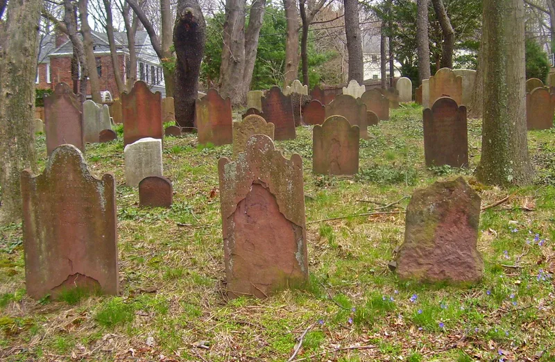
Monfort Cemetery is a small burial ground of less than an acre on a slope above the eastern end of Main Street in Port Washington. In 1786 Daniel Rapelje sold about one acre of his 110-acre farm to a group of related Dutch Reformed families for use as a common cemetery. Some markers are older, with the earliest dated 1737, so the land may have been used for burials earlier. The 118 surviving sandstone and marble markers date from 1737 to 1892 and are arranged in thirteen north-south rows assigned to families such as the Onderdonks, Hegemans, Schencks and Dodges. They include soul effigy stones, plain three-lobed markers, Neoclassical urn-and-willow designs, Victorian floral carvings and plain marble slabs. Together they show shifts in religious belief and social custom among local Dutch families. Revolutionary War patriots and historian Henry Onderdonk Jr. are buried here. The town received the cemetery in 1984.
Significance in brief: The nomination argues the cemetery is significant for its link to the early settlement and growth of the Cow Neck (Port Washington) area. It also holds a well-preserved collection of 18th and 19th century gravestones. The changing markers and epitaphs show how local Dutch Reformed families moved toward assimilation into mainstream American culture. Many early settlers, Revolutionary War patriots and community leaders are buried there.
Machine-generated summary. This summary was generated by a language model from the official nomination document and has not been reviewed line by line by an editor. It may contain errors. Check the source document before relying on any detail. Source: nomination document (PDF) · National Archives catalog entry. NRHP reference 87002301, listed January 7, 1988. Summary generated October 2026 (model claude-sonnet-5-5, prompt v1.0-2026-10-29, confidence high).
Key facts
| Address | E of Main St. and Port Washington Blvd., Port Washington |
|---|---|
| County | Nassau County |
| Listed | January 7, 1988 |
| Reference number | 87002301 |
| Resource type | Site |
| Period of significance | c. 1737-1886 |
| Areas of significance | Art, Exploration/Settlement, Social History |
| Level of significance | Local |
| Status (as stated in the nomination) | Described as in good condition with a high level of integrity; owned by the town and accessible to the public. The original farm setting has been compromised by suburban development. |
| Acreage | 1 |
| Coordinates | 40.83110, -73.68220 (NPS GIS) |
What listing means for this property
Sites (archaeological sites, battlefields, landscapes) are often listed with a restricted address to protect them from looting or disturbance. Listing is honorary for private owners; federal undertakings on or near the site go through Section 106 review, and state laws may protect burials and artefacts regardless of listing.
General information, not legal or tax advice. Rules change; confirm with your State Historic Preservation Office or a qualified adviser.
Sources and further reading
- National Park Service, National Register of Historic Places database (snapshot May 2026), reference 87002301.
- Nomination form (PDF, National Archives) — catalog entry
- Wikipedia article (used for cross-checking only; text not reproduced here)
- Wikidata Q6899369
- This listing as JSON
Last updated October 2026. Found an error? See the editorial policy for how to report it.