Riverside Park and Drive

Why it's listed
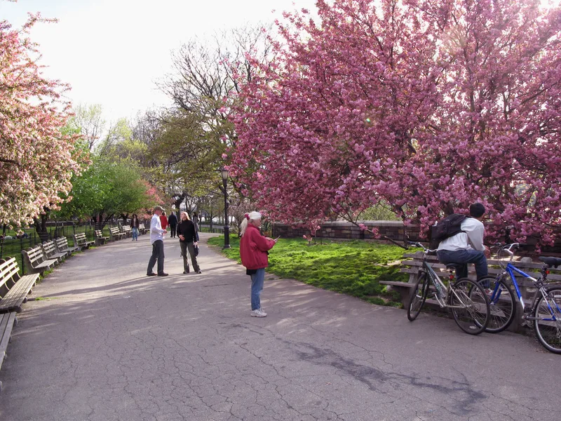
Riverside Park and Riverside Drive form a long, narrow park and curving roadway on Manhattan's Upper West Side, stretching from 72nd Street to roughly 129th Street beside the Hudson River. The land is arranged in levels: a tree-lined drive at the top, a steep planted hillside with winding paths, a plateau built when the railroad tracks were roofed over in the 1930s, and filled land at the river holding the marina, ballfields and the Henry Hudson Parkway. Frederick Law Olmsted's design, begun in 1874, made a usable park from a difficult slope, and later work under Robert Moses added 132 acres. Monuments such as Grant's Tomb and the Soldiers' and Sailors' Monument reflect the City Beautiful era, along with several memorials and statues. Eight playgrounds and other recreation facilities serve the area. The park and drive also encouraged residential development along the west side of Manhattan.
Significance in brief: The nomination argues the park is a significant landscape design by Olmsted and Vaux, distinctive for turning a steep, narrow riverside strip into a park with levels for driving, walking, and active recreation. It also reflects City Beautiful monuments and the 1930s Robert Moses expansion that added 132 acres down to the river. It was also a major spur to development on the Upper West Side.
Machine-generated summary. This summary was generated by a language model from the official nomination document and has not been reviewed line by line by an editor. It may contain errors. Check the source document before relying on any detail. Source: nomination document (PDF) · National Archives catalog entry. NRHP reference 83001743, listed September 2, 1983. Summary generated October 2026 (model claude-sonnet-5-5, prompt v1.0-2026-10-29, confidence medium).
Key facts
| Address | From 72nd St. to 129th St., New York |
|---|---|
| County | Manhattan |
| Listed | September 2, 1983 |
| Reference number | 83001743 |
| Resource type | Site |
| Architect / builder | Frederick Law Olmsted/Calvert Vaux, Robert Moses, Gilmore D. Clarke, Clinton Lloyd |
| Areas of significance | Landscape Architecture |
| Level of significance | Local |
| Status (as stated in the nomination) | Described as in excellent condition, occupied, publicly owned and open to the public; altered, with two later intrusions (a 1960s playground building and Columbia University tennis courts). |
| Acreage | 265 |
| Coordinates | 40.79947, -73.97399 (NPS GIS) |
What listing means for this property
Sites (archaeological sites, battlefields, landscapes) are often listed with a restricted address to protect them from looting or disturbance. Listing is honorary for private owners; federal undertakings on or near the site go through Section 106 review, and state laws may protect burials and artefacts regardless of listing.
General information, not legal or tax advice. Rules change; confirm with your State Historic Preservation Office or a qualified adviser.
Sources and further reading
- National Park Service, National Register of Historic Places database (snapshot May 2026), reference 83001743.
- Nomination form (PDF, National Archives) — catalog entry
- Wikipedia article (used for cross-checking only; text not reproduced here)
- Wikidata Q1339602
- This listing as JSON
Last updated October 2026. Found an error? See the editorial policy for how to report it.