High Bridge Aqueduct and Water Tower

Why it's listed
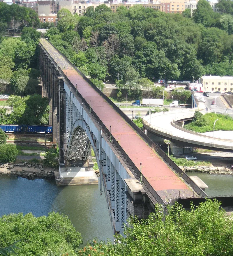
High Bridge carries the Croton Aqueduct across the Harlem River between the Bronx, at West 170th Street, and High Bridge Park in Manhattan. Construction began in the late 1830s and the masonry arch bridge was finished in 1848, delivering water to a city that had relied on wells, pumps and carted water. Designed in the manner of a Roman aqueduct, it was praised as magnificent and lofty. In 1850 the side walls were raised six feet to hold a larger pipe, and in 1923 Navy engineers replaced the central piers with a steel arch to improve river navigation. Near the Manhattan end stands an octagonal stone water tower of 1872, resembling a medieval campanile, which once supported a standpipe and iron tank. It is the only such tower left in the city. Its pumping role ended in 1949, and a carillon was installed in its belfry in 1958. Both structures remain landmarks on the skyline.
Significance in brief: High Bridge is described as an engineering triumph, unique in the country in its time, and the most visible section of the original Croton Aqueduct, which gave New York its first adequate public water supply. Carl Condit regarded it as a leading example of advancing size and structural quality in stone bridge construction. The water tower is the only one of its kind remaining in the city.
Machine-generated summary. This summary was generated by a language model from the official nomination document and has not been reviewed line by line by an editor. It may contain errors. Check the source document before relying on any detail. Source: nomination document (PDF) · National Archives catalog entry. NRHP reference 72001560, listed December 4, 1972. Summary generated October 2026 (model claude-sonnet-5-5, prompt v1.0-2026-10-29, confidence medium).
Key facts
| Address | Harlem River at W. 170th St. and High Bridge Park, New York |
|---|---|
| County | Manhattan |
| Listed | December 4, 1972 |
| Reference number | 72001560 |
| Resource type | Structure |
| Period of significance | 1838-1844, 1872 (19th Century) |
| Architect / builder | John B. Jervis (engineer; replaced David Bates Douglass, the first engineer, in 1836) |
| Areas of significance | Engineering |
| Level of significance | National |
| Status (as stated in the nomination) | Condition listed as excellent; some central masonry arches were replaced by a steel arch in 1923. The tower was relieved of pumping duty in 1949 and holds a carillon installed in 1958. The bridge is noted as formerly a pedestrian route that a neighborhood group hoped to reopen. |
| Acreage | 10 |
| Coordinates | 40.84229, -73.93042 (NPS GIS) |
What listing means for this property
For a publicly owned building or structure, listing mainly matters when federal funds, permits or licences are involved: projects then go through Section 106 review so effects on the property are considered. Listing also strengthens applications for preservation grants and, for leased income-producing uses, can enable the federal rehabilitation tax credit.
General information, not legal or tax advice. Rules change; confirm with your State Historic Preservation Office or a qualified adviser.
Sources and further reading
- National Park Service, National Register of Historic Places database (snapshot May 2026), reference 72001560.
- Nomination form (PDF, National Archives) — catalog entry
- Wikipedia article (used for cross-checking only; text not reproduced here)
- Wikidata Q5754953
- This listing as JSON
Last updated October 2026. Found an error? See the editorial policy for how to report it.