Sackets Harbor Battlefield
Also known as: Sackets Harbor Naval Station; Fort Tompkins Park

Why it's listed
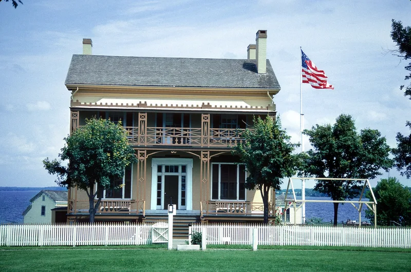
Sackets Harbor Battlefield covers about 260 acres of bluffs and shoreline above Black River Bay, including Horse Island. During the War of 1812 the village became the main American naval and military base on Lake Ontario, with shipyards, barracks, blockhouses and forts. British and Canadian forces attacked the defenses in July 1812 and May 1813, and both times the Americans drove them off. The area contains ruins of Fort Tompkins and Fort Kentucky, the site of Smith Cantonment, and the ground where the battles took place. Later it served as a naval station, and brick officers' houses, a stable and an icehouse from the mid-19th century survive. The Commandant's House dates to 1847-49 and the Lieutenant's House to 1849. The Navy left in 1955. Part of the battlefield became a public park in 1886 and passed to New York State in 1933. Excavations between 1967 and 1970 found much, and large areas remain unexplored.
Significance in brief: Sackets Harbor was the center of U.S. naval and military activity on Lake Ontario during the War of 1812, and American defenders repelled British attacks in 1812 and 1813. The site continued as a naval station through the 19th century, and its excavated and unexplored remains give it archeological importance.
Machine-generated summary. This summary was generated by a language model from the official nomination document and has not been reviewed line by line by an editor. It may contain errors. Check the source document before relying on any detail. Source: nomination document (PDF) · National Archives catalog entry. NRHP reference 74001247, listed December 31, 1974. Summary generated October 2026 (model claude-sonnet-5-5, prompt v1.0-2026-10-29, confidence medium).
Key facts
| Address | Coastline and area from Sackets Harbor SW to and including Horse Island, Sackets Harbor |
|---|---|
| County | Jefferson County |
| Listed | December 31, 1974 |
| Reference number | 74001247 |
| Resource type | Site |
| Period of significance | 19th Century |
| Areas of significance | Historic - Non-Aboriginal, Military, Architecture |
| Level of significance | State |
| Status (as stated in the nomination) | Part of the site is a state historic site and park. The Commandant's House and Lieutenant's House were restored by the State in 1973 to their 1865 appearance. Condition is marked good, and the property is in public ownership. |
| Acreage | 260 |
| Coordinates | 43.94547, -76.13271 (NPS GIS) |
What listing means for this property
Sites (archaeological sites, battlefields, landscapes) are often listed with a restricted address to protect them from looting or disturbance. Listing is honorary for private owners; federal undertakings on or near the site go through Section 106 review, and state laws may protect burials and artefacts regardless of listing.
General information, not legal or tax advice. Rules change; confirm with your State Historic Preservation Office or a qualified adviser.
Sources and further reading
- National Park Service, National Register of Historic Places database (snapshot May 2026), reference 74001247.
- Nomination form (PDF, National Archives) — catalog entry
- Wikipedia article (used for cross-checking only; text not reproduced here)
- Wikidata Q7396817
- This listing as JSON
Last updated October 2026. Found an error? See the editorial policy for how to report it.