Riverside Park

The pin is a point inside the NPS boundary polygon, not a surveyed location.
Why it's listed
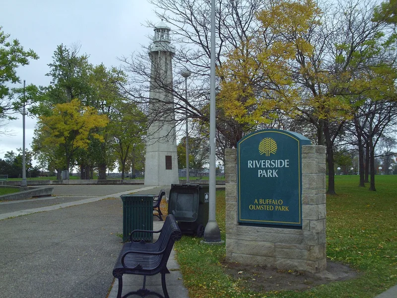
Riverside Park occupies a nearly rectangular bluff above the Niagara River in northern Buffalo, bounded by Vulcan Street, Tonawanda Street, Crowley Avenue and the New York State Thruway. The Olmsted Brothers implemented its plan in 1898, after Frederick Law Olmsted had retired, aiming to give visitors broad views of the river, Strawberry and Grand Islands and the Canadian shore. The design is formal and axially symmetrical, with pastoral, formal and active-recreation themes. Old oak and maple trees in the northern quarter probably survive from the original planting, and slight depressions mark the former minnow pools. A 1912 land purchase added about 17 acres for ball fields and other active recreation. Later changes include a pool, tennis courts, a Thruway off ramp and a 1979 ornamental lighthouse. The park was the final piece of Olmsted's Buffalo park system and shows how urban parks moved from picturesque landscapes toward organized sport.
Significance in brief: It is the last-implemented part of Olmsted's park system for Buffalo, completing three decades of Olmsted work that made the city a model of park and parkway planning. Its design combines pastoral, formal and active-recreation themes, and its 1912 expansion shows the shift in urban parks toward organized and spontaneous sport.
Machine-generated summary. This summary was generated by a language model from the official nomination document and has not been reviewed line by line by an editor. It may contain errors. Check the source document before relying on any detail. Source: nomination document (PDF) · National Archives catalog entry. NRHP reference 82005026, listed March 30, 1982. Summary generated October 2026 (model claude-sonnet-5-5, prompt v1.0-2026-10-29, confidence medium).
Key facts
| Address | Roughly bounded by Vulcan, Tonawanda, Crowley, and Niagara St., Buffalo |
|---|---|
| County | Erie County |
| Listed | March 30, 1982 |
| Reference number | 82005026 |
| Resource type | Structure |
| Architect / builder | Olmsted Brothers (plan implemented 1898, after Frederick Law Olmsted had retired) |
| Criteria |
|
| Areas of significance | Landscape Architecture |
| Level of significance | National |
| Status (as stated in the nomination) | Park in active recreational use, with a swimming pool, tennis courts, ball fields and a picnic area; some areas have been altered, but the north and south portions largely retain their integrity. |
| Acreage | 21.9 |
| Coordinates | 42.95515, -78.90858 (NPS GIS) |
What listing means for this property
For a publicly owned building or structure, listing mainly matters when federal funds, permits or licences are involved: projects then go through Section 106 review so effects on the property are considered. Listing also strengthens applications for preservation grants and, for leased income-producing uses, can enable the federal rehabilitation tax credit.
General information, not legal or tax advice. Rules change; confirm with your State Historic Preservation Office or a qualified adviser.
Sources and further reading
- National Park Service, National Register of Historic Places database (snapshot May 2026), reference 82005026.
- Nomination form (PDF, National Archives) — catalog entry
- Wikipedia article (used for cross-checking only; text not reproduced here)
- Wikidata Q7338564
- This listing as JSON
Last updated October 2026. Found an error? See the editorial policy for how to report it.