Hudson River Heritage Historic District

Why it's listed
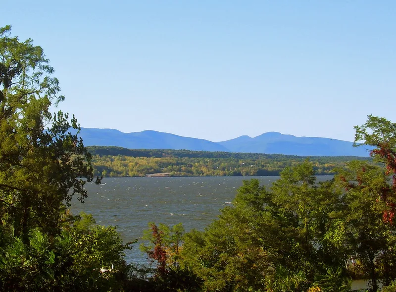
Stretching along the east bank of the Hudson River between Germantown and Staatsburg, this district covers about 22,000 acres in Dutchess and Columbia counties. It is best understood as a landscape rather than a group of buildings. About 40 country seats, usually on 200 to 300 acres, face the river and the Catskill Mountains. Their mansions, ornamental grounds and farms are linked by stone-walled roads, and five hamlets (Tivoli, Barrytown, Rhinecliff, Annandale and Staatsburg) served as landings, rail stops and commercial centers. Clermont, built by Robert Livingston Jr. around 1730, was the first seat and a model for the others. Most seats were in place by 1865. The district extends two earlier estate districts to include the farmland and settlements that gave the estates their context. Of 1,869 contributing and 701 non-contributing resources, the newer ones occupy under 2% of the acreage. Together they show how the river scenery and Livingston landholding shaped settlement over roughly three centuries.
Significance in brief: The nomination presents the district as a well-preserved designed and cultural landscape shaped over about 300 years by Livingston family country seats and the farms and hamlets around them. It argues the estates, tenant and freehold farms, roads and river settlements show the interaction of social classes. The Hudson River and Catskill views influenced how the land was settled and designed.
Machine-generated summary. This summary was generated by a language model from the official nomination document and has not been reviewed line by line by an editor. It may contain errors. Check the source document before relying on any detail. Source: nomination document (PDF) · National Archives catalog entry. NRHP reference 90002219, listed December 14, 1990. Summary generated October 2026 (model claude-sonnet-5-5, prompt v1.0-2026-10-29, confidence medium).
Key facts
| Address | E. side Hudson R. between Germantown and Staatsburg, Staatsburg |
|---|---|
| County | Dutchess County |
| Listed | December 14, 1990 |
| Reference number | 90002219 |
| Resource type | District |
| Architectural style | Colonial, Early Republic, Mid-19th Century, Late Victorian, Late 19th and 20th Century Revivals |
| Areas of significance | Exploration/Settlement, Social History, European, Architecture, Landscape Architecture |
| Level of significance | National |
| National Historic Landmark | Yes, designated December 14, 1990 |
| Status (as stated in the nomination) | The landscape is described as remarkably well preserved. Some estates have decayed or been subdivided, and non-contributing resources cover less than 2% of the district's acreage. |
| Coordinates | 41.89403, -73.94210 (NPS GIS) |
What listing means for this property
This is a historic district. Buildings within its boundary are either contributing (they add to the district's significance) or non-contributing. Owners of contributing income-producing buildings can claim the 20% federal rehabilitation tax credit; homeowners should look at state credits. National Register districts impose no design review by themselves; a local historic district ordinance, if one exists, does (the difference explained).
General information, not legal or tax advice. Rules change; confirm with your State Historic Preservation Office or a qualified adviser.
Sources and further reading
- National Park Service, National Register of Historic Places database (snapshot May 2026), reference 90002219.
- Nomination form (PDF, National Archives) — catalog entry
- Wikipedia article (used for cross-checking only; text not reproduced here)
- Wikidata Q5928845
- This listing as JSON
Last updated October 2026. Found an error? See the editorial policy for how to report it.