Coleman Station Historic District
Also known as: See Also:Hiddenhurst

Why it's listed
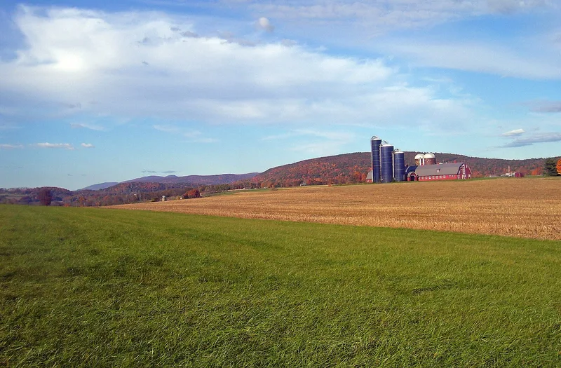
Coleman Station is a small farming hamlet in a hollow where the Webatuck Creek and its tributaries meet, near the New York-Connecticut line south of Millerton. Settlers from Connecticut and Massachusetts began buying land in the 1750s and 1760s, and families such as the Wheelers, Collins and Dakins established farms on the hillsides facing the valley. A farmhouse on Coleman Station Road carries a date stone reading 1771. The Harlem Valley Railroad arrived in 1851, giving the place its name from landowner Amasa Coleman and adding grist and plaster mills, mining of peat, slate and iron, and later a milk plant and ice pond. In the early 1900s businessman Thomas Hidden built the Hiddenhurst country estate, later replaced in part by a large dairy farm. The district includes 60 contributing buildings, a cemetery and preserved farm landscapes, and it is regarded as representative of the wider Oblong region.
Significance in brief: The nomination argues the district embodies the development of the Oblong (Harlem Valley) from mid-18th-century settlement by New England migrants, through railroad-era industrialization after 1851, to 20th-century dairy operations. It cites the density, antiquity, quality and integrity of its buildings and landscape, and its clearly defined topographic and social boundaries.
Machine-generated summary. This summary was generated by a language model from the official nomination document and has not been reviewed line by line by an editor. It may contain errors. Check the source document before relying on any detail. Source: nomination document (PDF) · National Archives catalog entry. NRHP reference 93000945, listed September 30, 1993. Summary generated October 2026 (model claude-sonnet-5-5, prompt v1.0-2026-10-29, confidence medium).
Key facts
| Address | Coleman Station, Indian Lake, Regan and Sheffield Hill Rds., Millerton |
|---|---|
| County | Dutchess County |
| Listed | September 30, 1993 |
| Reference number | 93000945 |
| Resource type | District |
| Architectural style | Colonial; Early Republic; Late 19th & Early 20th Century Revivals |
| Areas of significance | Industry, Agriculture, Exploration/Settlement, Architecture |
| Level of significance | Local |
| Status (as stated in the nomination) | Some historic buildings have been lost, including a stone and brick farmhouse and the Sheffield Farms house (demolished 1970s) and barn (1980s). Current functions listed include single dwellings, farm uses, cemetery and school. |
| Acreage | 1812 |
| Coordinates | 41.90110, -73.52043 (NPS GIS) |
What listing means for this property
This is a historic district. Buildings within its boundary are either contributing (they add to the district's significance) or non-contributing. Owners of contributing income-producing buildings can claim the 20% federal rehabilitation tax credit; homeowners should look at state credits. National Register districts impose no design review by themselves; a local historic district ordinance, if one exists, does (the difference explained).
General information, not legal or tax advice. Rules change; confirm with your State Historic Preservation Office or a qualified adviser.
Sources and further reading
- National Park Service, National Register of Historic Places database (snapshot May 2026), reference 93000945.
- Nomination form (PDF, National Archives) — catalog entry
- Wikipedia article (used for cross-checking only; text not reproduced here)
- Wikidata Q5143032
- This listing as JSON
Last updated October 2026. Found an error? See the editorial policy for how to report it.