Jefferson Street Cemetery

Why it's listed
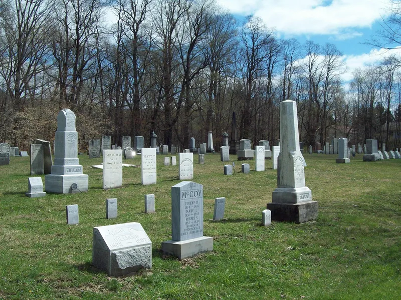
Jefferson Street Cemetery is a small burial ground of about 1.75 acres on the edge of Ellicottville, New York, set between Jefferson Street and Great Valley Creek. It was laid out in 1817 after the death of a child created the need for a burial plot. Graves run in north-to-south rows, oriented east to west, with markers of sandstone, marble, and granite carved with willows, urns, lambs, and Masonic or military symbols. Burials date from 1817 to 2003, and a volunteer committee has recorded 413 of them. Those interred include early settlers such as Baker Leonard and members of the Fox and Huntley families, newspaper publisher Delos Sill, veterans of the War of 1812 and Civil War, and two African American residents, William Sheffield and Martha Maybee. The cemetery was recognized for its link to the settlement and social history of Ellicottville, a former county seat, and for the demographic information its records preserve. The town owns and maintains the site.
Significance in brief: The cemetery is the village's first burial ground and holds the graves of many early settlers, prominent business owners, politicians, and War of 1812 and Civil War veterans. It is significant under Criterion A in Exploration/Settlement and Social History, with Criteria Consideration D for cemeteries. The burial records also give demographic information about the early village that is often missing from surviving town and village records.
Machine-generated summary. This summary was generated by a language model from the official nomination document and has not been reviewed line by line by an editor. It may contain errors. Check the source document before relying on any detail. Source: nomination document (PDF) · National Archives catalog entry. NRHP reference 11000994, listed January 4, 2012. Summary generated October 2026 (model claude-sonnet-5-5, prompt v1.0-2026-10-29, confidence high).
Key facts
| Address | E. side of Jefferson St. between Martha St. & Aspen Dr., Ellicottville |
|---|---|
| County | Cattaraugus County |
| Listed | January 4, 2012 |
| Reference number | 11000994 |
| Resource type | Site |
| Period of significance | 1817-1961 |
| Criteria |
|
| Areas of significance | Exploration/Settlement, Social History |
| Level of significance | Local |
| Status (as stated in the nomination) | Listed as still active but inactive in practice; the most recent burial was in 2003, and only two burials have taken place after 1961. Most markers are in good condition, though some are broken, weathered, or obscured by growth. |
| Acreage | 1.8 |
| Coordinates | 42.27245, -78.66838 (NPS GIS) |
What listing means for this property
Sites (archaeological sites, battlefields, landscapes) are often listed with a restricted address to protect them from looting or disturbance. Listing is honorary for private owners; federal undertakings on or near the site go through Section 106 review, and state laws may protect burials and artefacts regardless of listing.
General information, not legal or tax advice. Rules change; confirm with your State Historic Preservation Office or a qualified adviser.
Sources and further reading
- National Park Service, National Register of Historic Places database (snapshot May 2026), reference 11000994.
- Nomination form (PDF, National Archives) — catalog entry
- Wikipedia article (used for cross-checking only; text not reproduced here)
- Wikidata Q14706641
- This listing as JSON
Last updated October 2026. Found an error? See the editorial policy for how to report it.