Sunset Park Historic District

Why it's listed
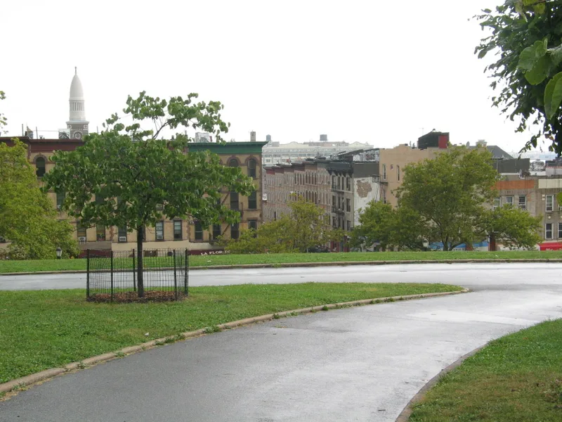
Sunset Park Historic District covers much of the Brooklyn neighborhood of Sunset Park, running up to twenty-seven blocks north to south and three blocks wide. It holds 3,237 contributing buildings across seventy-one blocks, plus Sunset Park itself. The area is mainly residential, with a low-rise scale of two-story row houses and three- to five-story apartment buildings, and mixed-use buildings with shops below and apartments above line the avenues, especially Fifth Avenue. Brick is the main facade material, with stone rows concentrated between Fourth and Fifth avenues. Building styles trace a progression from frame houses with Italianate and neo-Grec detail, through Queen Anne and Romanesque Revival forms of the 1890s, to the neo-Renaissance style that dominates the district. Many houses were built by speculative builders as two-family homes. Finnish cooperative apartments arranged around central courts add an unusual note. Churches, schools and banks supply the main institutional landmarks. Together the buildings create a cohesive neighborhood set apart from its surroundings.
Significance in brief: The district is an architecturally cohesive neighborhood of row houses, multiple dwellings and mixed-use buildings that share a low-rise scale and use of materials. Its buildings show a progression from neo-Grec and Romanesque Revival to neo-Renaissance styles, and it includes unusual Finnish cooperative apartments with central courts. The excerpt does not give the full significance statement.
Machine-generated summary. This summary was generated by a language model from the official nomination document and has not been reviewed line by line by an editor. It may contain errors. Check the source document before relying on any detail. Source: nomination document (PDF) · National Archives catalog entry. NRHP reference 88001464, listed September 15, 1988. Summary generated October 2026 (model claude-sonnet-5-5, prompt v1.0-2026-10-29, confidence medium).
Key facts
| Address | Roughly bounded by Fourth Ave., Thirty-eighth St., Seventh Ave. and Sixty-fourth St., Brooklyn |
|---|---|
| County | Brooklyn |
| Listed | September 15, 1988 |
| Reference number | 88001464 |
| Resource type | District |
| Architect / builder | Henry Spicer & Son; George Walkinshaw; Robert W. Frith; Thomas W. Edwards; Thomas Bennett; Koch & Wagner; Cohn Bros.; and other speculative builders and builder/architects |
| Architectural style | Neo-Grec, Queen Anne, Romanesque Revival, neo-Renaissance |
| Areas of significance | Architecture |
| Level of significance | Local |
| Status (as stated in the nomination) | Condition is given as excellent, good and fair, with both altered and unaltered buildings. Many frame houses have been resided, and 205 non-contributing buildings and 14 non-contributing vacant sites are noted. |
| Acreage | 280 |
| Coordinates | 40.64826, -74.00449 (NPS GIS) |
What listing means for this property
This is a historic district. Buildings within its boundary are either contributing (they add to the district's significance) or non-contributing. Owners of contributing income-producing buildings can claim the 20% federal rehabilitation tax credit; homeowners should look at state credits. National Register districts impose no design review by themselves; a local historic district ordinance, if one exists, does (the difference explained).
General information, not legal or tax advice. Rules change; confirm with your State Historic Preservation Office or a qualified adviser.
Sources and further reading
- National Park Service, National Register of Historic Places database (snapshot May 2026), reference 88001464.
- Nomination form (PDF, National Archives) — catalog entry
- Wikipedia article (used for cross-checking only; text not reproduced here)
- Wikidata Q2270906
- This listing as JSON
Last updated October 2026. Found an error? See the editorial policy for how to report it.