Charlton Center Historic District

Why it's listed
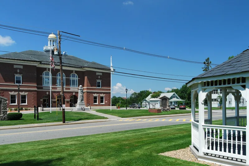
Charlton Center is a village core of about 85 acres laid out along a drumlin ridge in central Charlton, Massachusetts. A long elliptical Common anchors the district, with the Town Hall and Charlton High School facing each other across it and a church, cemetery and monuments nearby. Most of the 54 contributing resources are modest houses, many in Federal, Greek Revival, Italianate and early twentieth-century styles, dating from 1775 to 1944. The oldest is the Salem Town House of 1775. Other notable buildings include the Ebenezer Collier House of 1820, described as the finest Federal example in town, and General John Spurr's house of 1798. The center took shape after Ebenezer McIntire donated land for a meetinghouse, common and burying ground in the 1750s and 1760s. Industry and commerce later grew elsewhere in town, leaving the Center as its civic heart. Spacious lots, mature trees and surrounding farmland preserve its village character.
Significance in brief: The district preserves the institutional and residential core of Charlton, which developed from land donated in the 1750s-60s for a meetinghouse, common and burying ground. It contains Federal, Greek Revival, Italianate, Queen Anne and Colonial Revival buildings, including homes of prominent early figures such as Salem Town and General John Spurr. The topography, spacious lots and surrounding farmland still show how the center developed.
Machine-generated summary. This summary was generated by a language model from the official nomination document and has not been reviewed line by line by an editor. It may contain errors. Check the source document before relying on any detail. Source: nomination document (PDF) · National Archives catalog entry. NRHP reference 95001227, listed October 20, 1995. Summary generated October 2026 (model claude-sonnet-5-5, prompt v1.0-2026-10-29, confidence medium).
Key facts
| Address | Roughly, Main St. from Mugget Hill Rd. to Masonic Home Rd. and adjacent roads, Charlton |
|---|---|
| County | Worcester County |
| Listed | October 20, 1995 |
| Reference number | 95001227 |
| Resource type | District |
| Architectural style | Federal; Greek Revival; Italianate; Queen Anne; Colonial and Classical Revival; Bungalow/Craftsman |
| Areas of significance | Architecture, Community Planning and Development |
| Level of significance | Local |
| Status (as stated in the nomination) | Most contributing properties remain in residential use; four former commercial buildings have been converted to residences, and the Town Hall, school, church and cemetery remain in institutional use. |
| Acreage | 85 |
| Coordinates | 42.13440, -71.97001 (NPS GIS) |
What listing means for this property
This is a historic district. Buildings within its boundary are either contributing (they add to the district's significance) or non-contributing. Owners of contributing income-producing buildings can claim the 20% federal rehabilitation tax credit; homeowners should look at state credits. National Register districts impose no design review by themselves; a local historic district ordinance, if one exists, does (the difference explained).
General information, not legal or tax advice. Rules change; confirm with your State Historic Preservation Office or a qualified adviser.
Sources and further reading
- National Park Service, National Register of Historic Places database (snapshot May 2026), reference 95001227.
- Nomination form (PDF, National Archives) — catalog entry
- Wikipedia article (used for cross-checking only; text not reproduced here)
- Wikidata Q5086293
- This listing as JSON
Last updated October 2026. Found an error? See the editorial policy for how to report it.