Ayer Main Street Historic District

Why it's listed
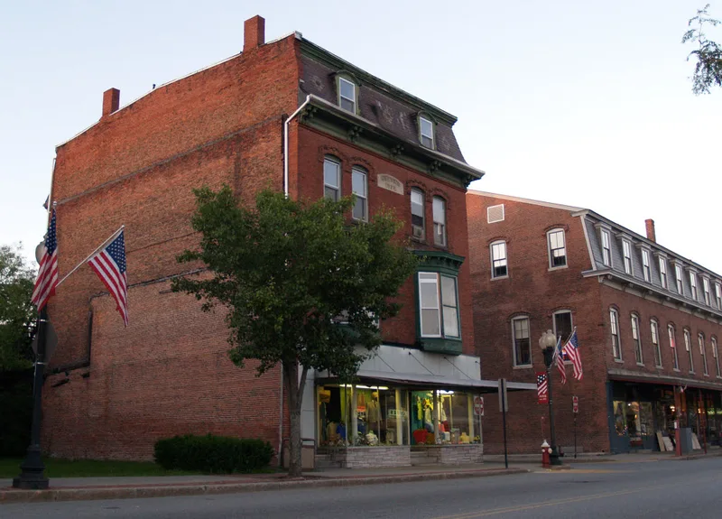
Main Street in Ayer, Massachusetts, is a compact commercial district of about eight acres that grew up around a railroad crossing. Before the 1840s the area was farmland, but the arrival of four rail lines at what was called Groton Junction turned it into a commercial center. A fire in 1872 destroyed the wooden business district, and by 1898 most of the brick blocks seen today had been built in High Victorian Gothic, Second Empire, Italianate and Neo-Classical styles. They include Page's Block, Mead's Block, the Nutting Block, the 1876 Town Hall and the 1898 North Middlesex Savings Bank. A second phase of building on the south side of Main Street began in 1914 and added commercial blocks and later roadside structures tied to Routes 2A and 111. The district has 12 contributing buildings. Its significance rests on its ties to commerce, transportation and commercial architecture between 1848 and 1938.
Significance in brief: The district is argued to be a regional example of the prosperity that came with railroad development in the mid-to-late 19th century. Ayer grew from farmland into a commercial center serving the railroad junction. Its dense group of multi-story brick commercial buildings, rebuilt after the 1872 fire in several Victorian styles, is uncommon in the area. It was also significant for architecture and for continued growth along the Route 2A and 111 highways.
Machine-generated summary. This summary was generated by a language model from the official nomination document and has not been reviewed line by line by an editor. It may contain errors. Check the source document before relying on any detail. Source: nomination document (PDF) · National Archives catalog entry. NRHP reference 88000193, listed March 16, 1989. Summary generated October 2026 (model claude-sonnet-5-5, prompt v1.0-2026-10-29, confidence medium).
Key facts
| Address | Main St. roughly between Park and Columbia Sts., Ayer |
|---|---|
| County | Worcester County |
| Listed | March 16, 1989 |
| Reference number | 88000193 |
| Resource type | District |
| Period of significance | 1848-1938 |
| Architectural style | Mid-19th-Century Vernacular, Second Empire, Italianate |
| Criteria |
|
| Areas of significance | Commerce, Architecture |
| Level of significance | Local |
| Status (as stated in the nomination) | Many storefronts have been modernized, though upper-level historic details are largely intact. One noncontributing building is described as vacant in one version of the text. |
| Acreage | 5.5 |
| Coordinates | 42.55970, -71.58801 (NPS GIS) |
What listing means for this property
This is a historic district. Buildings within its boundary are either contributing (they add to the district's significance) or non-contributing. Owners of contributing income-producing buildings can claim the 20% federal rehabilitation tax credit; homeowners should look at state credits. National Register districts impose no design review by themselves; a local historic district ordinance, if one exists, does (the difference explained).
General information, not legal or tax advice. Rules change; confirm with your State Historic Preservation Office or a qualified adviser.
Sources and further reading
- National Park Service, National Register of Historic Places database (snapshot May 2026), reference 88000193.
- Nomination form (PDF, National Archives) — catalog entry
- Wikipedia article (used for cross-checking only; text not reproduced here)
- Wikidata Q4831165
- This listing as JSON
Last updated October 2026. Found an error? See the editorial policy for how to report it.