Morton Street, Metropolitan Park System of Greater Boston

Why it's listed
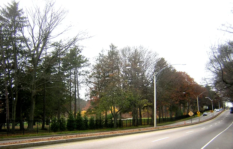
Morton Street is a parkway about two and a half miles long that crosses southwestern Boston, from the Arborway rotary in Jamaica Plain to Fairmont Street near Gallivan Boulevard in Dorchester. Built in the 1930s by either the state Department of Public Works or the City of Boston, it linked the Emerald Necklace with Gallivan Boulevard and served the Forest Hills Cemetery and Franklin Park. The first segment runs between the park and cemetery, with two lanes each way, a turf median, granite curbs, bicycle lanes and rows of oaks. The second segment passes through dense neighborhoods of triple-decker houses and commercial blocks. In 1956, financial pressures led Boston to hand nearly twenty local parkways, including this one, to the Metropolitan District Commission. Its configuration and materials match the commission's parkway design approach. It was recognized for its role in planning, engineering, landscape architecture and transportation, with a period of significance from the 1930s to 1956.
Significance in brief: The parkway was built to link the Arborway of the Emerald Necklace with Gallivan Boulevard and to connect Forest Hills Cemetery and Franklin Park. Its layout and materials reflect the design philosophy of the Metropolitan District Commission's parkways. It was transferred from the city to the MDC in 1956 and is significant at the state level for community planning, engineering, landscape architecture and transportation.
Machine-generated summary. This summary was generated by a language model from the official nomination document and has not been reviewed line by line by an editor. It may contain errors. Check the source document before relying on any detail. Source: nomination document (PDF) · National Archives catalog entry. NRHP reference 04001572, listed January 24, 2005. Summary generated October 2026 (model claude-sonnet-5-5, prompt v1.0-2026-10-29, confidence medium).
Key facts
| Address | Morton St., Boston |
|---|---|
| County | Suffolk County |
| Listed | January 24, 2005 |
| Reference number | 04001572 |
| Resource type | District |
| Period of significance | 1930s-1956 |
| Architect / builder | City of Boston, Massachusetts Department of Public Works |
| Criteria |
|
| Areas of significance | Community Planning and Development, Engineering, Landscape Architecture, Transportation |
| Level of significance | State |
| Status (as stated in the nomination) | Continues in use as a parkway and road; the Penn Central railroad overpass is noted as non-contributing because its rails were replaced. |
| Acreage | 13 |
| Coordinates | 42.28958, -71.09477 (NPS GIS) |
What listing means for this property
This is a historic district. Buildings within its boundary are either contributing (they add to the district's significance) or non-contributing. Owners of contributing income-producing buildings can claim the 20% federal rehabilitation tax credit; homeowners should look at state credits. National Register districts impose no design review by themselves; a local historic district ordinance, if one exists, does (the difference explained).
General information, not legal or tax advice. Rules change; confirm with your State Historic Preservation Office or a qualified adviser.
Sources and further reading
- National Park Service, National Register of Historic Places database (snapshot May 2026), reference 04001572.
- Nomination form (PDF, National Archives) — catalog entry
- Wikipedia article (used for cross-checking only; text not reproduced here)
- Wikidata Q48767852
- This listing as JSON
Last updated October 2026. Found an error? See the editorial policy for how to report it.